Oklahoma Social Studies 3.C.2.2.B
The Standard
- 3.C.2
- Examine Oklahoma’s geography and how people of Oklahoma interact with their environment.
- 3.C.2.2
- Examine Oklahoma’s political and physical features using physical and political maps.
Distinguish between relative location and absolute location (latitude and longitude) to describe the location of Oklahoma’s major natural and human features on maps and globes.
Oklahoma Academic Standards for Social Studies (2026) · 3.C.2.2
Teacher's field guide
What This Standard Means
What Students Need to Do
- Students find Oklahoma City, Tulsa, the Red River, and the Wichita Mountains on maps and globes. They describe locations using nearby places or compass directions. They also read approximate latitude and longitude for a chosen point.
What Mastery Looks Like
- A student can locate Tulsa near 36° N, 96° W and say it is northeast of Oklahoma City. For the Red River, they choose a spot before giving its coordinates.
Common Misconceptions
- Students may call “north of Oklahoma City” an absolute location. They may swap latitude and longitude or give one coordinate pair for an entire river.
How to Assess It
- Give students a map showing Tulsa, Oklahoma City, and the Red River, with latitude and longitude lines. Ask: “What are Tulsa’s approximate coordinates, and where is the Red River compared with Oklahoma City?”
Lesson moves
Ways to Teach It
Place a dot on Oklahoma City and trace the Red River on a paper map, then describe both using nearby places and grid lines.
Ask students to write two descriptions of Tulsa, one using Oklahoma City and one using latitude and longitude.
Give pairs Oklahoma maps and clue cards; have them match Tulsa and Oklahoma City to coordinates, then locate the Red River using position clues.
On a gridded state map, find Tulsa’s coordinates and write a text telling a visitor how to travel there from Oklahoma City.
Free download
Printable 3.C.2.2.B Worksheet
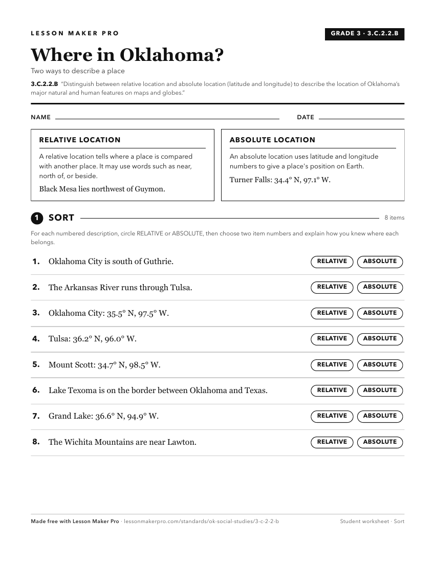
A ready-to-print activity worksheet aligned to 3.C.2.2.B, with an answer key for the teacher on its own page. No account needed.
PDF, US Letter, prints cleanly in black and white.
Download the worksheetKeep exploring
Related Standards
- 3.C.2.2
Examine Oklahoma’s political and physical features using physical and political maps.
- 6.C.1.2.B
Use the system of latitude and longitude to identify the absolute location of a place on maps and globes.
- 3.C.2.2.A
Explain the relative location of the student’s school and the state of Oklahoma to surrounding states and major physical regions of the United States of America...
- 3.C.2.2.D
Use both political and physical maps to identify Oklahoma’s major landforms, bodies of water, and major metropolitan centers, recognizing the Native origins of ...
Turn this exact standard into a lesson
Grade, subject, topic, and the complete standard are prefilled. Create one free, no account needed.
Also for this standard:Make a WorksheetMake a QuizMake a Sub Lesson