NGSS 4-ESS2-2
The Standard
Analyze and interpret data from maps to describe patterns of Earth's features.
Next Generation Science Standards
Teacher's field guide
What This Standard Means
What Students Need to Do
- Students read map titles, keys, symbols, colors, and elevation lines. They compare maps to find where landforms and geologic events cluster, align, or overlap.
What Mastery Looks Like
- Students use titles, keys, symbols, and elevation colors correctly. They identify clusters, lines, and overlaps among features, then support each description with map evidence.
Common Misconceptions
- Students may treat colors as decoration instead of using the map key. They may assume earthquakes, volcanoes, and mountains are spread evenly or that elevation and land area mean the same thing.
How to Assess It
- Give students two small maps, one showing earthquakes and one showing mountains and boundaries. Ask, "Describe one pattern you see and cite two map details as evidence."
Lesson moves
Ways to Teach It
Layer transparent maps of earthquakes, volcanoes, mountains, and boundaries, then circle places where two or more features overlap.
Show a topographic map and ask students to write, "What pattern do you notice, and which map evidence supports it?"
Play Map Pattern Match by pairing feature cards with map sections showing clusters, lines, high elevations, ridges, or trenches.
Compare a local elevation map with road and town maps, then discuss how landforms may affect where people build and travel.
Free download
Printable 4-ESS2-2 Worksheet
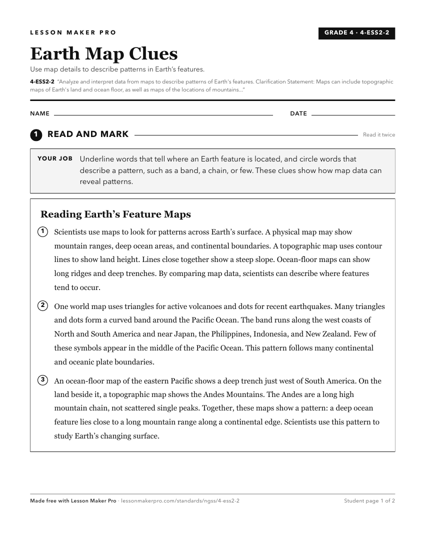
A ready-to-print activity worksheet aligned to 4-ESS2-2, with an answer key for the teacher on its own page. No account needed.
PDF, US Letter, prints cleanly in black and white.
Download the worksheetLearning progression
Where This Standard Sits
See the whole path on the Earth & Space Science progression map.
What This Unlocks
Mastery here sets students up for these next.
Keep exploring
Related Standards
- MS-ESS1-3
Analyze and interpret data to determine scale properties of objects in the solar system.
- 3-LS4-1
Analyze and interpret data from fossils to provide evidence of the organisms and the environments in which they lived long ago.
- HS-ESS2-1
Develop a model to illustrate how Earth's internal and surface processes operate at different spatial and temporal scales to form continental and ocean-floor fe...
Turn this exact standard into a lesson
Grade, subject, topic, and the complete standard are prefilled. Create one free, no account needed.
Also for this standard:Make a WorksheetMake a QuizMake a Sub Lesson