Mississippi Science MAQ.4.1
The Standard
- MAQ.4
- Students will examine characteristics of specific aquatic ecosystems and the effects of human and natural phenomena on those ecosystems.
Compare and contrast the unique biotic and abiotic characteristics of the following selected aquatic ecosystems: intertidal zone, wetlands/estuaries, coral reef, barrier islands, continental slope/shelf, abyss, rivers/streams/watersheds, and lakes/ponds.
2026 Mississippi College- and Career-Readiness Standards for Science · Flora and Fauna
Teacher's field guide
What This Standard Means
What Students Need to Do
- Students compare salinity, light, depth, tides, and sediment across aquatic habitats. They identify organisms in intertidal zones, estuaries, reefs, barrier islands, the shelf and slope, the abyss, rivers and watersheds, and lakes and ponds. They explain how the conditions in each place affect what lives there.
What Mastery Looks Like
- Students can match each habitat with its physical conditions and typical organisms. They can explain why corals live in shallow, sunlit water but not the dark abyss, and why salt-tolerant grasses grow in estuaries.
Common Misconceptions
- Students may think estuaries contain only freshwater, even though river water mixes with seawater there. Some assume nothing lives in the abyss. Others confuse sandy barrier islands with coral reefs.
How to Assess It
- Exit ticket: Compare a shallow, sunlit continental shelf with the dark abyss. Name one physical difference, one organism in each place, and explain why seagrass grows in only one.
Lesson moves
Ways to Teach It
Use sand, water, and a sponge in a tray to model how a barrier island and wetland change wave movement.
Show photos of a reef and the abyss, then ask students to write how light affects the organisms in each.
Have pairs sort eight habitat cards by salinity, depth, and light, then defend two placements using clues on the cards.
Use a local watershed map to trace rainwater to a stream or lake, then mark where road runoff could enter.
Free download
Printable MAQ.4.1 Worksheet
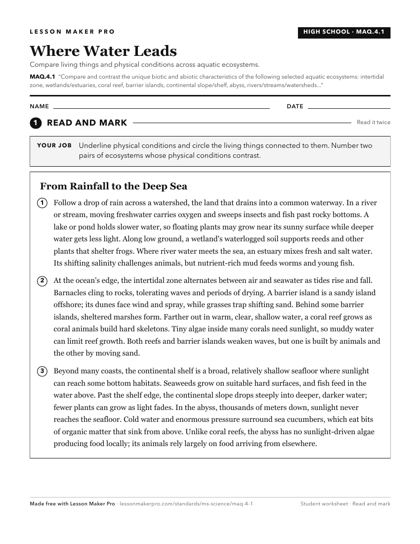
A ready-to-print activity worksheet aligned to MAQ.4.1, with an answer key for the teacher on its own page. No account needed.
PDF, US Letter, prints cleanly in black and white.
Download the worksheetKeep exploring
Related Standards
- L.5.3B.1
Obtain and evaluate scientific information regarding the characteristics of different ecosystems and the organisms they support (e.g., salt and fresh water, des...
- MAQ.4.2
Recognize representative examples of plants and animals that would be specifically adapted to the aquatic ecosystems and identify adaptations necessary to survi...
- MAQ.4
Students will examine characteristics of specific aquatic ecosystems and the effects of human and natural phenomena on those ecosystems.
- FB.6.1
Compare and contrast biotic and abiotic factors.
Turn this exact standard into a lesson
Grade, subject, topic, and the complete standard are prefilled. Create one free, no account needed.
Also for this standard:Make a WorksheetMake a QuizMake a Sub Lesson