Mississippi Science MAQ.1.5
The Standard
- MAQ.1
- Students will develop an understanding of the unique physical and chemical properties of water and how those properties shape life on Earth.
Research, analyze, and communicate current technology and career opportunities available to collect this data on a global scale using CTD, buoy data, or satellites.
2026 Mississippi College- and Career-Readiness Standards for Science · Water Properties and Quality
Teacher's field guide
What This Standard Means
What Students Need to Do
- Students research CTDs, ocean buoys, and satellites using current sources. They compare what each tool measures, where it collects data, and what it cannot show. They explain which ocean jobs collect or analyze the data.
What Mastery Looks Like
- A student can explain that a CTD measures conditions through the water at one site, a buoy tracks conditions near its location, and a satellite covers a wide surface area. They cite a source and describe a task done by a marine technician or satellite data analyst.
Common Misconceptions
- Students may think satellites measure deep water or that one buoy represents an entire ocean. Some mistake a CTD for a permanent station or assume every ocean science job happens on a ship.
How to Assess It
- Give students short NOAA or NASA fact cards for the three tools. Ask: “Which tool would map surface temperature across the globe, which would check temperature at depth, what does each miss, and what job uses the data? Cite one card.”
Lesson moves
Ways to Teach It
Place CTD, buoy, and satellite cards on a world map; use yarn to mark each tool's sampling area.
Read current NOAA tool and career pages, then write a recommendation naming one tool, its limits, and a job that uses its data.
Play a tool-match relay: sort measurement cards by instrument, then defend one tricky match using a fact card.
Compare a NOAA buoy temperature graph with a NASA sea surface temperature map, then choose a site where a marine technician should take a CTD reading.
Free download
Printable MAQ.1.5 Worksheet
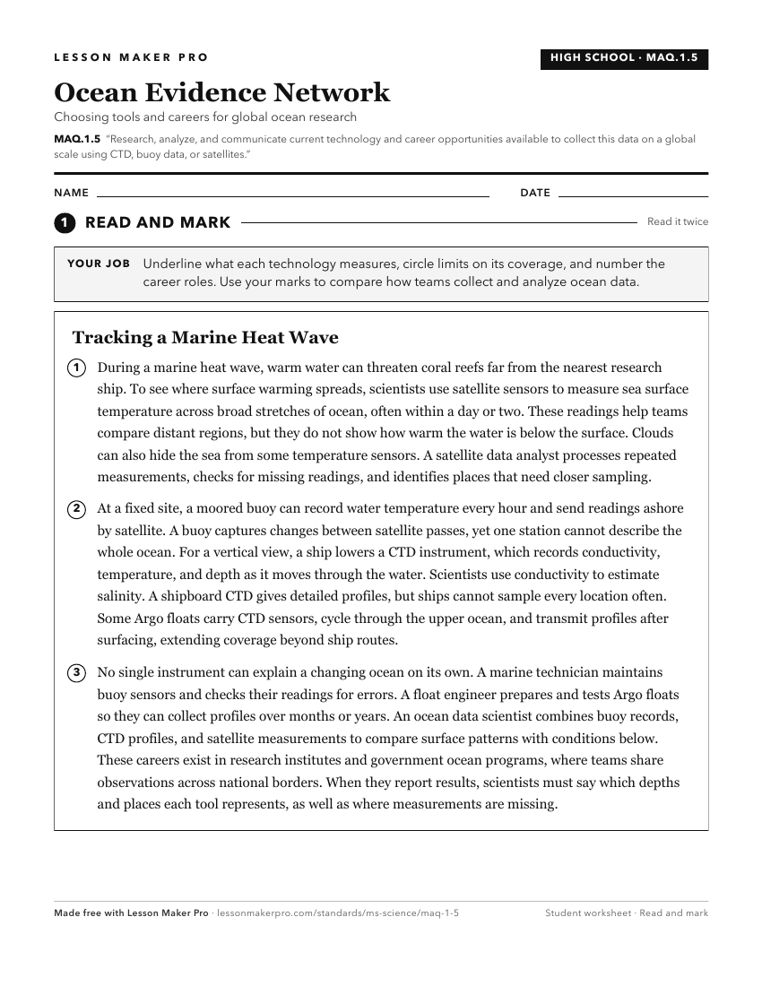
A ready-to-print activity worksheet aligned to MAQ.1.5, with an answer key for the teacher on its own page. No account needed.
PDF, US Letter, prints cleanly in black and white.
Download the worksheetKeep exploring
Related Standards
- MAQ.2.4
Research, analyze, and communicate scientific arguments to support climate models that predict how global and regional climate change can affect Earth’s systems...
- MAQ.4.6
Research, analyze, and communicate the effects of natural phenomena (e.g., hurricanes, floods, drought, and sea-level rise) on the aquatic ecosystems.
- MAQ.3.1
Use geospatial data to analyze, explain, and communicate differences among the major geological features of specific aquatic ecosystems (e.g., plate tectonics, ...
- MAQ.1.4
Collect, analyze, and communicate quantitative data that includes dissolved oxygen, pH, temperature, salinity, mineral content, nitrogen compounds, and turbidit...
Turn this exact standard into a lesson
Grade, subject, topic, and the complete standard are prefilled. Create one free, no account needed.
Also for this standard:Make a WorksheetMake a QuizMake a Sub Lesson