Mississippi Science ENV.3.2
The Standard
- ENV.3
- Students will discuss the direct and indirect impacts of certain types of human activities on the Earth’s climate.
Interpret data and climate models to predict how global and regional climate change can affect Earth’s systems (e.g., precipitation, temperature, impacts on sea level, global ice volumes, and atmosphere and ocean composition).
2026 Mississippi College- and Career-Readiness Standards for Science · Human Activities and Climate Change
Teacher's field guide
What This Standard Means
What Students Need to Do
- Students read measured climate trends and model projections, checking the dates, locations, and assumptions. They use those patterns to predict changes in rainfall, temperature, ice, sea level, or ocean conditions.
What Mastery Looks Like
- Given a temperature graph and a regional rainfall projection map, a student reads the scale and legend to describe each change. They support a prediction with numbers and distinguish observed data from a model projection.
Common Misconceptions
- Students may treat a model projection as a record of what has already happened or as a guaranteed forecast. They may assume warming means every region gets less rain, or that melting floating sea ice raises sea level like melting land ice.
How to Assess It
- Hand out a measured global temperature graph and a 2050 rainfall projection map with one region circled. Ask: “What rainfall change is predicted there, what number on the map supports your answer, and which source shows observations?”
Lesson moves
Ways to Teach It
Give pairs a printed 2050 rainfall projection map and tracing paper; have them outline two regions and record each region’s projected change.
Show a land-ice graph and a sea-level projection; ask students to write how the trends relate and where the projection begins.
Make cards with observed climate graphs and model projections; teams sort them and defend their choices using dates and labels.
Use a projected summer temperature map for your state to choose one heat safety rule for school sports, citing the map legend.
Free download
Printable ENV.3.2 Worksheet
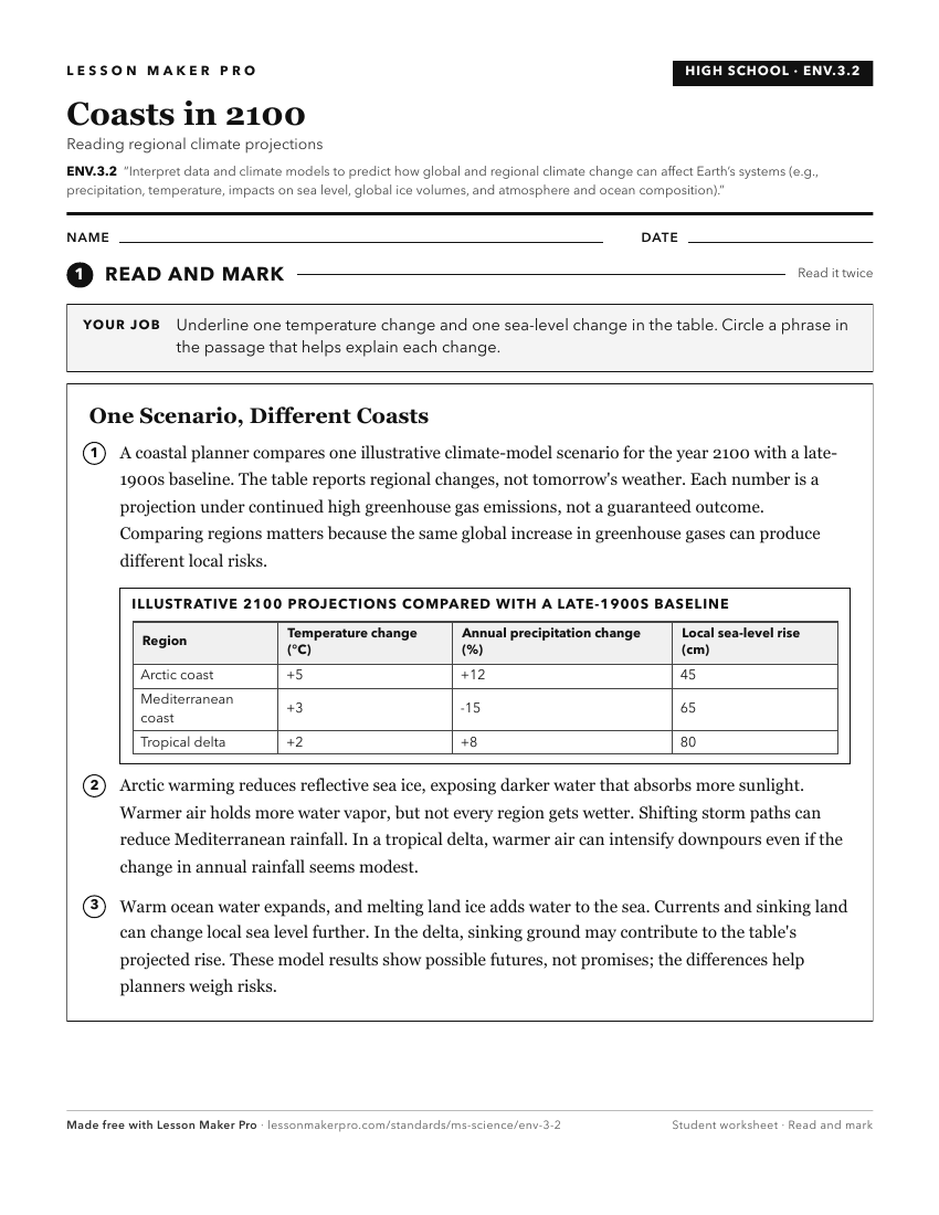
A ready-to-print activity worksheet aligned to ENV.3.2, with an answer key for the teacher on its own page. No account needed.
PDF, US Letter, prints cleanly in black and white.
Download the worksheetKeep exploring
Related Standards
- MAQ.2.4
Research, analyze, and communicate scientific arguments to support climate models that predict how global and regional climate change can affect Earth’s systems...
- E.4.9B.1
Analyze and interpret data (e.g., temperature, precipitation, wind speed/direction, relative humidity, or cloud types) to predict changes in weather over time.
- E.4.9C.1
Analyze and interpret data to describe (i.e., NASA, NOAA, USGS) and predict how natural processes (e.g., weathering, erosion, deposition, earthquakes, tsunamis,...
- E.7.9A.3
Interpret atmospheric data from satellites, radar, and weather maps to predict weather patterns and conditions.
Turn this exact standard into a lesson
Grade, subject, topic, and the complete standard are prefilled. Create one free, no account needed.
Also for this standard:Make a WorksheetMake a QuizMake a Sub Lesson