Mississippi Science E.7.9A.7
The Standard
- E.7.9A
- Students will demonstrate an understanding of how complex changes in the movement and patterns of air and water molecules caused by the sun, winds, landforms, ocean temperatures, and currents in the atmosphere are major determinants of local and global weather patterns.
Interpret topographic maps to predict how local and regional geography affect weather patterns and make them difficult to predict.
2026 Mississippi College- and Career-Readiness Standards for Science · Earth’s Systems and Cycles
Teacher's field guide
What This Standard Means
What Students Need to Do
- Students read contour lines and elevation labels to find ridges, valleys, and steep slopes. They use a given wind direction to predict where rain or wind may differ across the map. They explain why one regional forecast may miss local conditions.
What Mastery Looks Like
- A student uses closely spaced contours to identify a steep slope, not a high elevation. Given moist wind blowing toward a ridge, they identify the windward side as likelier to get rain and explain why the valley beyond it may stay drier.
Common Misconceptions
- Students may think closely spaced contours always mean high elevation, rather than a steep slope. They may assume both sides of a mountain get the same rain. Some think a contour map alone can show exactly when rain will start.
How to Assess It
- Sketch contour lines around a ridge with a valley to its east, and add a moist wind arrow from the west. Ask students to circle the likelier rainy slope, explain why the valley may stay drier, and name one change that could alter their prediction.
Lesson moves
Ways to Teach It
Stack cardboard contour cutouts into a ridge, then place a wind arrow and cotton balls where rain is most likely.
Show two towns on opposite sides of a ridge and ask students to write why the same rain forecast might miss one town.
Give pairs contour-map cards and wind arrows; have them race to mark the likely wetter side, then check each other's reasons.
Use a printed contour map of your town to mark a low valley where cold air may collect on a clear night.
Free download
Printable E.7.9A.7 Worksheet
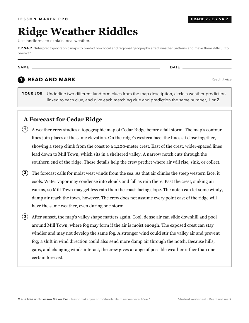
A ready-to-print activity worksheet aligned to E.7.9A.7, with an answer key for the teacher on its own page. No account needed.
PDF, US Letter, prints cleanly in black and white.
Download the worksheetKeep exploring
Related Standards
- E.7.9A.1
Analyze and interpret weather patterns from various regions to differentiate between weather and climate.
- ESS.3.5
Analyze and interpret weather data using maps and global weather systems to explain and communicate the relationships among air masses, pressure systems, and fr...
- E.4.9B.1
Analyze and interpret data (e.g., temperature, precipitation, wind speed/direction, relative humidity, or cloud types) to predict changes in weather over time.
- E.7.9A.3
Interpret atmospheric data from satellites, radar, and weather maps to predict weather patterns and conditions.
Turn this exact standard into a lesson
Grade, subject, topic, and the complete standard are prefilled. Create one free, no account needed.
Also for this standard:Make a WorksheetMake a QuizMake a Sub Lesson