Indiana Social Studies WG.1.4
The Standard
Evaluate the applications of geographic tools (locational technologies) and supporting technologies to serve particular purposes.
2026 Indiana Academic Standards: K-12 Social Studies
Teacher's field guide
What This Standard Means
What Students Need to Do
- Students choose geographic tools for a specific job, such as finding a safe route after a flood. They explain what GPS, maps, satellite images, and updated road data can tell them, and what each might miss.
What Mastery Looks Like
- A student uses GPS to find a current position and a road map to plan a route. They check for recent closure reports rather than assuming the map shows which roads are open.
Common Misconceptions
- Students may think GPS shows road closures, when it only gives a position. They may treat a satellite image as live or assume a map app needs cell service to use GPS.
How to Assess It
- Exit ticket: Cell service is out after a flood. Choose two tools from a GPS receiver, a downloaded road map, and last month's satellite image to help a driver, then name one limit of each.
Lesson moves
Ways to Teach It
Give pairs printed road and flood-zone maps; have them trace an evacuation route and mark where they need newer road information.
Ask: Would you trust yesterday's satellite image or a live road-closure report after a flood? Write two reasons for your choice.
Play tool match with cards naming tasks and tools, including GPS, satellite images, downloaded maps, and road-closure feeds; require a reason for each match.
Compare a local bus app with a printed timetable; ask students which shows scheduled arrivals and which can show a late bus.
Free download
Printable WG.1.4 Worksheet
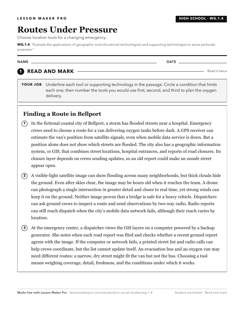
A ready-to-print activity worksheet aligned to WG.1.4, with an answer key for the teacher on its own page. No account needed.
PDF, US Letter, prints cleanly in black and white.
Download the worksheetKeep exploring
Related Standards
- WG.1.1
Use locational technology such as longitude, latitude, and remote sensing, Global Positioning Systems (GPS) and Geographic Information Systems (GIS), to establi...
- K.G.4
Identify maps and globes as tools that represent the Earth and identify and describe differences between land and water.
- GHW.9.2
Identify and describe ways in which humans have used technology to modify the physical environment in order to settle areas in different world regions, and eval...
- WG.1.5
Ask geographic questions and obtain answers from a variety of sources, such as books, atlases and other written materials; statistical source material; fieldwor...
Turn this exact standard into a lesson
Grade, subject, topic, and the complete standard are prefilled. Create one free, no account needed.
Also for this standard:Make a WorksheetMake a QuizMake a Sub Lesson