Indiana Social Studies IS.3.8
The Standard
Read and interpret texts (written, graphs, maps, imagery, timelines) to answer geographic questions about Indiana in the past and present and to plan for Indiana’s future.
2026 Indiana Academic Standards: K-12 Social Studies
Teacher's field guide
What This Standard Means
What Students Need to Do
- Students use maps, graphs, images, timelines, and written sources to answer questions about Indiana places. They compare past and present evidence, then use it to suggest a future choice.
What Mastery Looks Like
- A student can use a map detail and a graph value to explain a change in an Indiana county. They can propose where to place a new service, support the choice with evidence, and name data they still need.
Common Misconceptions
- Students may treat an old map as current or compare maps without checking dates, scales, and keys. They may assume population growth alone proves a county needs a new highway.
How to Assess It
- Show a 1950 Indiana road map and a current one. Ask students to name one change, suggest a transit corridor, cite both maps, and name one fact they still need.
Lesson moves
Ways to Teach It
Give pairs a 1950 Indiana road map and a current map; have them trace new interstate routes and label two towns they connect.
Show a county population graph and highway map; ask students to write which county might need better transit and what evidence is missing.
Give teams two dated Indiana maps and a county population graph; award points for claims they can support with two sources.
Use a local floodplain map and street map to choose a site for a new library; explain access and flood risk.
Free download
Printable IS.3.8 Worksheet
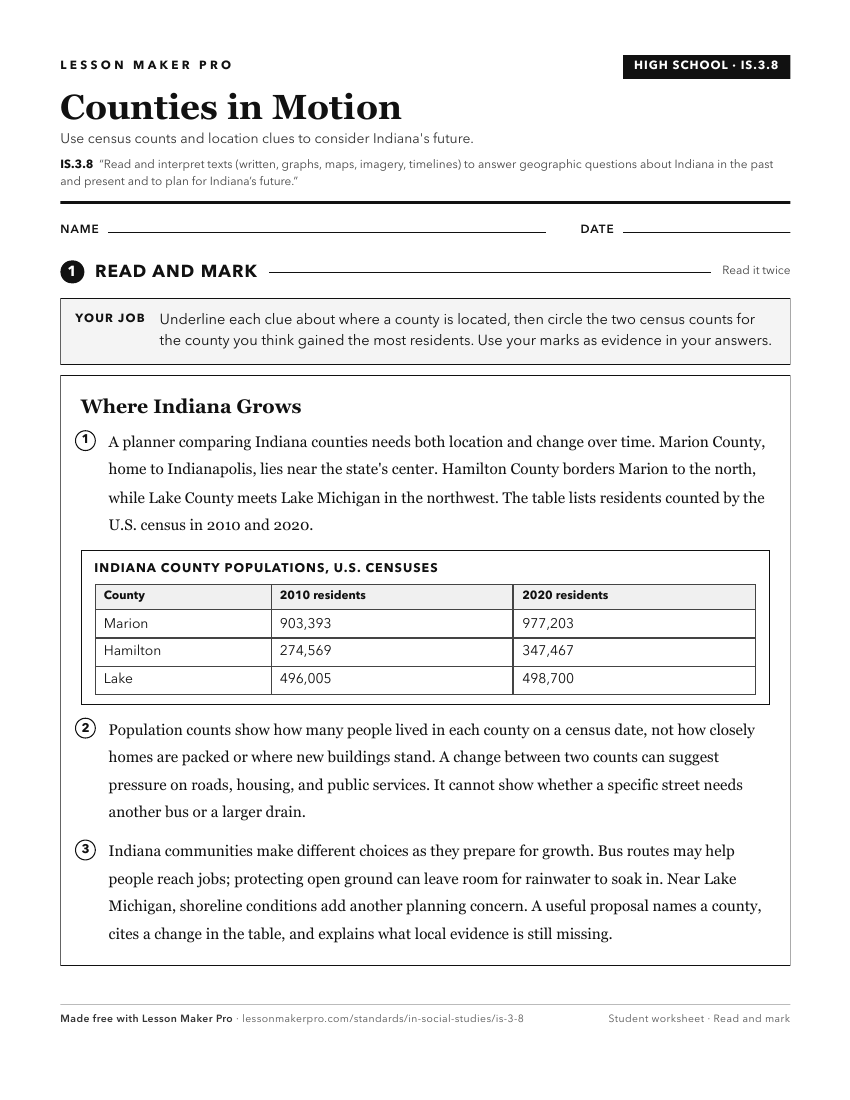
A ready-to-print activity worksheet aligned to IS.3.8, with an answer key for the teacher on its own page. No account needed.
PDF, US Letter, prints cleanly in black and white.
Download the worksheetKeep exploring
Related Standards
- IS.3.7
Examine Indiana’s relationships with states, countries, and world regions and understand the significance of these relationships to Indiana’s past, present, and...
- 3.G.6
Compare and contrast the physical characteristics of Indiana to neighboring states using words, illustrations, maps, photographs, and other resources.
- IS.3.6
Identify immigration and migration patterns and describe their impact on the developments of agriculture, industry, mining, and transportation in Indiana.
- 4.H.13
Create and interpret timelines that show relationships among people, events, and movements in the history of Indiana.
Turn this exact standard into a lesson
Grade, subject, topic, and the complete standard are prefilled. Create one free, no account needed.
Also for this standard:Make a WorksheetMake a QuizMake a Sub Lesson