Indiana Social Studies GHW.7.3
The Standard
Prepare a variety of texts (writing, maps, timelines, and/or other graphic representations) to trace the development and geographic extent of a variety of regional and global cooperative organizations during different time periods. Describe their establishment and assess their success or lack of success, consequences for citizens, and the role of particular countries in achieving the goals the organizations were established to accomplish.
2026 Indiana Academic Standards: K-12 Social Studies
Teacher's field guide
What This Standard Means
What Students Need to Do
- Students make maps, timelines, and short explanations about cooperative organizations from different periods. They show when and why each formed, where it operated, and how it changed. They judge its results, including effects on citizens and the actions of specific countries.
What Mastery Looks Like
- A student can map membership at two points in time and mark key events on a timeline. They can explain why each organization began and use evidence to judge a success or failure. They can name a country's role and describe what the outcome meant for citizens.
Common Misconceptions
- Students may assume that forming an organization means it achieved its goal. They may treat membership as fixed or confuse members with countries where the group worked. They may credit the whole organization for one country's actions or leave out effects on civilians.
How to Assess It
- Exit ticket: Give students a 1930 League of Nations map and a 1950 United Nations map. Using class notes, ask them to name one geographic difference, each group's founding reason, and one country action linked to a result for civilians.
Lesson moves
Ways to Teach It
Give pairs blank maps, 1930 League and 1950 United Nations member lists, and colored pencils; shade members and mark founding years on a timeline.
Ask: How did Japan's invasion of Manchuria expose the League's limits, and what happened to people living there?
Sort cards labeled League 1931, United Nations 1950, Japan, United States, Manchuria, Korea, and civilian effects into two evidence-backed explanations.
Read a current United Nations peacekeeping mission page; locate the operation on a map and compare its goal with one reported effect on residents.
Free download
Printable GHW.7.3 Worksheet
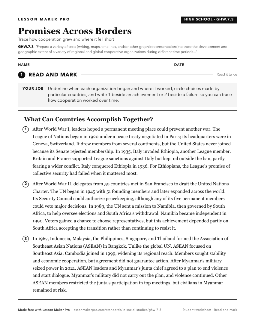
A ready-to-print activity worksheet aligned to GHW.7.3, with an answer key for the teacher on its own page. No account needed.
PDF, US Letter, prints cleanly in black and white.
Download the worksheetKeep exploring
Related Standards
- GHW.5.2
Describe, using a variety of texts (writing, maps, timelines, and/or other graphic representations), the worldwide trend toward urbanization and the changing fu...
- GHW.8.1
Use maps to show the location and distribution of Earth’s resources, and analyze how this distribution changes over time and affects trade among countries, regi...
- GHW.8.2
Prepare graphic representations, such as maps, tables, and timelines, to describe the global movement of goods and services between and among countries and worl...
- GHW.6.2
Use a variety of texts (writing, maps, timelines, and/or other graphic representations) to show the origin and spread of specific innovations. Assess the impact...
Turn this exact standard into a lesson
Grade, subject, topic, and the complete standard are prefilled. Create one free, no account needed.
Also for this standard:Make a WorksheetMake a QuizMake a Sub Lesson