Indiana Social Studies GHW.10.2
The Standard
Use a variety of data, such as atlases, written materials, and statistical source materials to identify countries of the world that are true nation-states, and draw conclusions about why certain regions of the world contain more nation-states than others.
2026 Indiana Academic Standards: K-12 Social Studies
Teacher's field guide
What This Standard Means
What Students Need to Do
- Students compare country borders with maps and population data to judge how closely states match national groups. They use border histories to explain why close matches are more common in some regions.
What Mastery Looks Like
- A student can explain why Iceland is a closer match than Nigeria, using evidence from a map and a data table. They can connect regional patterns to how borders were drawn without claiming every country in a region is alike.
Common Misconceptions
- Students may treat a nation and a state as the same thing. They may think one official language proves a shared national identity, or that every European country fits neatly while no African country does.
How to Assess It
- Give students political and language maps for Iceland, Portugal, Nigeria, and Cameroon, plus a short note on colonial borders. Ask them to name one closer match and explain one regional pattern using two sources.
Lesson moves
Ways to Teach It
Give pairs political maps, language maps, and census tables for Iceland, Portugal, Nigeria, and Cameroon; students mark possible border-group mismatches.
Ask, 'Can a country have one main language and still contain several nations?' Have students answer using a Japan or Nigeria source card.
Play a claim-check game: teams use map and census cards to accept, reject, or qualify the claim that one language means one nation.
Compare a Yoruba language map with the Nigeria-Benin border; students mark where Yoruba communities live in two states and connect this to colonial borders.
Free download
Printable GHW.10.2 Worksheet
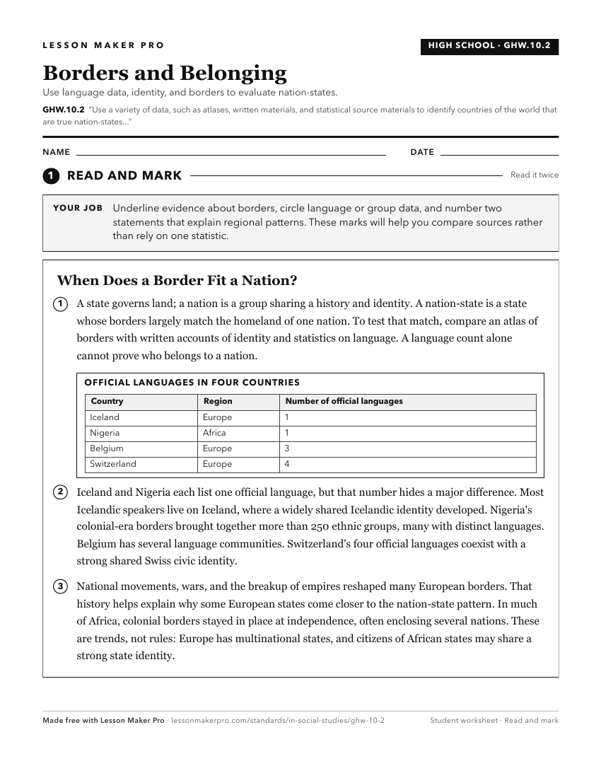
A ready-to-print activity worksheet aligned to GHW.10.2, with an answer key for the teacher on its own page. No account needed.
PDF, US Letter, prints cleanly in black and white.
Download the worksheetKeep exploring
Related Standards
- GE.4.1
Synthesize evidence which suggests that most of the world’s countries are interdependent.
- WG.4.1
Using maps, establish world patterns of population distribution, density, and growth. Relate population growth rates to health statistics, food supply, or measu...
- WG.1.5
Ask geographic questions and obtain answers from a variety of sources, such as books, atlases and other written materials; statistical source material; fieldwor...
- GHW.10.1
Differentiate between a state (country) and a nation, specifically focusing on the concepts of territorial control and self-determination of internal and foreig...
Turn this exact standard into a lesson
Grade, subject, topic, and the complete standard are prefilled. Create one free, no account needed.
Also for this standard:Make a WorksheetMake a QuizMake a Sub Lesson