Georgia SS4G2.b
The Standard
- SS4G2
- Describe how physical systems affect human systems.
Describe physical barriers that hindered and physical gateways that benefited territorial expansion from 1801 to 1861.
Georgia Standards of Excellence for Social Studies · Describe how physical systems affect human systems.
Teacher's field guide
What This Standard Means
What Students Need to Do
- Students identify landforms and waterways that slowed or supported westward movement between 1801 and 1861. They explain how mountains, deserts, rivers, and passes affected travel, settlement, and trade.
What Mastery Looks Like
- Students can locate examples such as the Rocky Mountains, Mississippi River, Missouri River, and Cumberland Gap on a map. They can explain why each feature acted as a barrier, gateway, or both.
Common Misconceptions
- Students may label roads and canals as physical features, even though people built them. They may also assume rivers always helped travel, overlooking strong currents, floods, and difficult crossings.
How to Assess It
- Give students a blank United States map. Ask them to mark one physical barrier and one physical gateway, then explain each choice in one sentence.
Lesson moves
Ways to Teach It
Build a relief map with clay, then trace possible western routes around mountains and along rivers.
Write a response to this prompt: Which physical feature would most affect your route west, and why?
Sort feature cards into barrier, gateway, or both, then earn a point by defending each choice with geographic evidence.
Compare a modern highway route through a mountain pass with a nearby direct route, noting how landforms still shape travel.
Free download
Printable SS4G2.b Worksheet
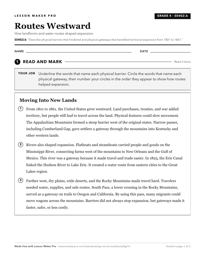
A ready-to-print activity worksheet aligned to SS4G2.b, with an answer key for the teacher on its own page. No account needed.
PDF, US Letter, prints cleanly in black and white.
Download the worksheetKeep exploring
Related Standards
- SS4H3.c
Describe territorial expansion with emphasis on the Louisiana Purchase, the Lewis and Clark expedition, and the acquisitions of Texas (the Alamo and independenc...
- SS4G2.a
Explain how each force (American and British) attempted to use the physical geography of each battle site (Lexington and Concord, Saratoga, and Yorktown) to its...
- SS3H2.a
Describe the reasons for and obstacles to the exploration of North America.
- SS8H4
Explain significant factors that affected westward expansion in Georgia between 1789 and 1840.
Turn this exact standard into a lesson
Grade, subject, topic, and the complete standard are prefilled. Create one free, no account needed.
Also for this standard:Make a WorksheetMake a QuizMake a Sub Lesson