Florida SS.3.G.1.5
The Standard
- SS.3.G.1
- The World in Spatial Terms
Compare maps and globes to develop an understanding of the concept of distortion.
Florida Next Generation Sunshine State Standards for Social Studies
Teacher's field guide
What This Standard Means
What Students Need to Do
- Students compare how the same places, shapes, sizes, and distances appear on a flat map and a globe. They explain that flattening a round Earth changes how some features look.
What Mastery Looks Like
- Given a world map and globe, students locate the same landforms and point out differences in size or shape. They explain why those differences occur.
Common Misconceptions
- Students may think a flat map shows every place at its exact size and shape. They may also think differences between a map and globe mean the geography itself changed.
How to Assess It
- Show a world map and globe. Ask students to name one place that looks different and explain why in one sentence.
Lesson moves
Ways to Teach It
Draw simple shapes on an orange, peel it, flatten the peel, and observe cracks, gaps, and changes in shape.
Compare Greenland and Africa on a map and globe, then write which model better shows their relative sizes and why.
Play map detective by having teams find three differences in shapes, sizes, or distances between a world map and globe.
Choose whether a pilot planning an overseas flight should begin with a flat map or globe, then defend the choice.
Free download
Printable SS.3.G.1.5 Worksheet
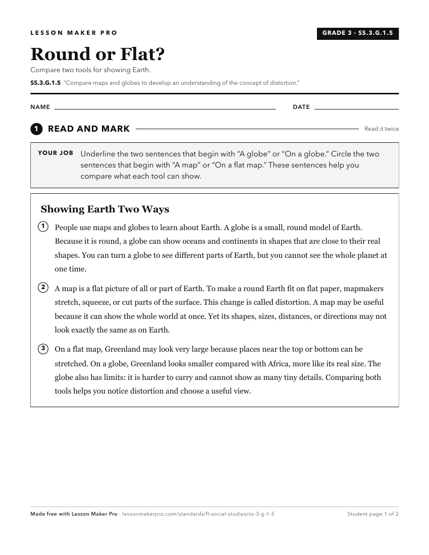
A ready-to-print activity worksheet aligned to SS.3.G.1.5, with an answer key for the teacher on its own page. No account needed.
PDF, US Letter, prints cleanly in black and white.
Download the worksheetKeep exploring
Related Standards
- SS.1.G.1.4
Identify a variety of physical features using a map and globe.
- SS.K.G.1.2
Explain that maps and globes help to locate different places and that globes are a model of the Earth.
- SS.K.G.1.4
Differentiate land and water features on simple maps and globes.
- SS.1.G.1.2
Identify key elements (i.e., compass rose, cardinal directions, title, key, or legend with symbols) of maps and globes.
Turn this exact standard into a lesson
Grade, subject, topic, and the complete standard are prefilled. Create one free, no account needed.
Also for this standard:Make a WorksheetMake a QuizMake a Sub Lesson