Alabama Social Studies SS24.7.4
Standard Cluster
Explain how artifacts and other archaeological findings provide evidence of the nature and movement of prehistoric groups of people. 4a Differentiate among primary, secondary, and tertiary sources in how they are used to study both history and geography. 4b Use maps to identify how climate and weather patterns, including the Ice Ages, affect the ways humans adapt within different geographic locations. 4c Predict causes and consequences of human migration, including push and pull factors.
2024 Alabama Course of Study: Social Studies
Cluster contents
Standards in This Cluster
SS24.7.4 is a cluster heading. These are the individual standards under it.
- SS24.7.4a
Differentiate among primary, secondary, and tertiary sources in how they are used to study both history and geography.
- SS24.7.4b
Use maps to identify how climate and weather patterns, including the Ice Ages, affect the ways humans adapt within different geographic locations.
- SS24.7.4c
Predict causes and consequences of human migration, including push and pull factors.
Teacher's field guide
What This Cluster Means
What Students Need to Do
- Students use artifacts and other findings to infer how prehistoric people lived and moved. They tell original evidence apart from later explanations and reference summaries. They use maps of ice sheets, climate, and weather to explain adaptations, migration choices, and what changed after a move.
What Mastery Looks Like
- Given matching stone tools at two sites and an Ice Age map, a student draws a plausible route and cites both clues. They label a stone tool primary, a historian's explanation secondary, and an encyclopedia summary tertiary. They name a push factor, a pull factor, an adaptation, and one result of migration.
Common Misconceptions
- Students may treat matching tools at two sites as proof of one migration route. They may call a textbook primary because it shows artifact photos, or confuse an encyclopedia summary with a historian's explanation. They may assume Ice Age conditions were the same everywhere or that people moved only to escape cold.
How to Assess It
- Give students an Ice Age map showing an ice sheet, two sites with matching stone tools, and a river plain, alongside a stone tool, a historian's paragraph, and an encyclopedia entry. Ask them to label the three sources, draw a possible route, and name one push factor, one pull factor, and one likely change after arrival.
Lesson moves
Ways to Teach It
Place replica tools and animal bone photos at two spots on a floor map; students sketch a possible route and cite two clues.
Ask, 'Why might a group leave an icy valley for a river plain, and how might their arrival change life there?'
Hand out cards showing a stone tool, a historian's explanation, and an encyclopedia entry; teams sort them as primary, secondary, or tertiary.
Compare local storm and road closure maps; students explain a travel detour, then trace a route around ice on an Ice Age map.
Free download
Printable SS24.7.4 Worksheet
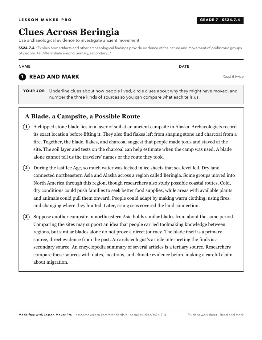
A ready-to-print activity worksheet aligned to SS24.7.4, with an answer key for the teacher on its own page. No account needed.
PDF, US Letter, prints cleanly in black and white.
Download the worksheetKeep exploring
Related Standards
- SS24.7.5
Explain common patterns that emerged in the shift from hunter-gatherer societies to permanent settlements in different regions of the world, including types and...
- SS24.3.8a
Identify changes that took place in prehistoric/pre-contact cultures in the Southeast between the Paleo, Archaic, Woodland, and Mississippian periods.
- SS24.S.7b
Trace the development of various types of social groups from hunter-gatherer societies to the present day and explain how the importance of primary and secondar...
- SS24.HG.10
Describe patterns of settlement in different regions of the world.
Turn this cluster into a lesson
Grade, subject, topic, and the complete cluster are prefilled. Create one free, no account needed.
Also for this cluster:Make a WorksheetMake a QuizMake a Sub Lesson