Alabama Social Studies SS24.4.2
The Standard
Compare and contrast the physical geography of the Northern, Middle, and Southern colonies, including geographic features and differences in climate, and explain how geography impacted settlement.
2024 Alabama Course of Study: Social Studies
Teacher's field guide
What This Standard Means
What Students Need to Do
- Students compare the land, waterways, and climate of the three colonial regions. They explain how those conditions shaped where people built towns and farms.
What Mastery Looks Like
- A student can identify rocky soil and harbors in the North, fertile river valleys in the Middle, and warm coastal plains in the South. They can explain why these places supported port towns, grain farms, or large farms.
Common Misconceptions
- Students may think every Northern settler fished or every Southern settler lived on a plantation. They may confuse a day's weather with climate or assume all three regions had the same soil.
How to Assess It
- On a three-region map, label one land or climate feature in each region and write how each feature affected where people settled.
Lesson moves
Ways to Teach It
Give pairs physical maps and climate cards; have them place paper town, farm, and plantation markers and explain each choice.
Ask, 'Why might settlers choose a Northern harbor instead of farmland near a Middle Colonies river?' Have students cite the maps.
Play a card sort matching rocky soil, fertile river valleys, and long growing seasons to likely settlements; have students defend each match.
Use maps of Boston, Philadelphia, and Charleston; have students locate ports and rivers and explain why each city grew there.
Free download
Printable SS24.4.2 Worksheet
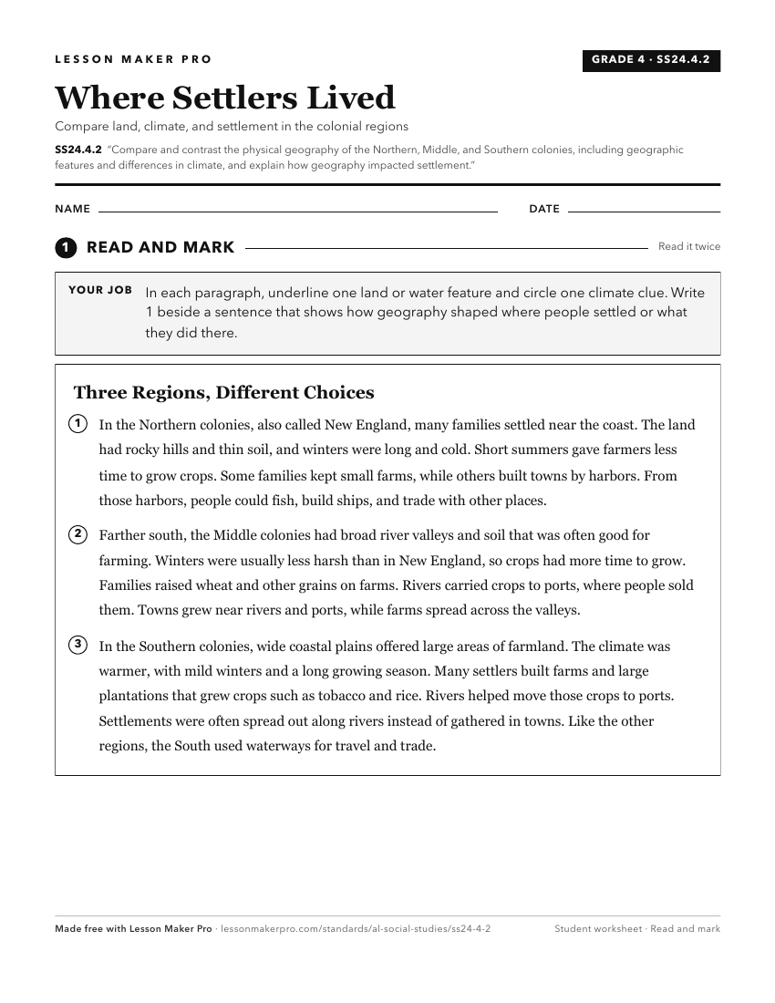
A ready-to-print activity worksheet aligned to SS24.4.2, with an answer key for the teacher on its own page. No account needed.
PDF, US Letter, prints cleanly in black and white.
Download the worksheetKeep exploring
Related Standards
- SS24.2.9
Compare the physical characteristics of regions throughout the United States, including landforms.
- SS24.6.4
Compare and contrast the key characteristics, including political structures, of the New England, Middle, Chesapeake, and Southern colonies.
- SS24.6.2
Compare and contrast the reasons for British, French, and Spanish colonization in North America as well as why individuals migrated to the colonies, including m...
- SS24.6.4a
Explain how climate and geography shaped the economic identities of the colonial regions.
Turn this exact standard into a lesson
Grade, subject, topic, and the complete standard are prefilled. Create one free, no account needed.
Also for this standard:Make a WorksheetMake a QuizMake a Sub Lesson