Alabama Science ESS.6.d
The Standard
- ESS.6
- Obtain, evaluate, and communicate information about the theory of plate tectonics.
Analyze data to interpret seismic activity and assess the risk of volcanic eruptions and earthquakes in Alabama and other areas in the United States.
2023 Alabama Course of Study: Science · Earth’s Systems
Teacher's field guide
What This Standard Means
What Students Need to Do
- Students read earthquake records for location, magnitude, depth, and changes over time. They compare Alabama with other U.S. regions and check where active volcanoes are located.
What Mastery Looks Like
- A student can use map data to explain why Alabama can have earthquakes but has little volcanic eruption risk. They can compare risks across regions without claiming to predict the date of an event.
Common Misconceptions
- Students may think Alabama cannot have earthquakes because it has no active volcanoes. They may treat a cluster of small quakes as proof that an eruption is coming, or assume a quiet month means an area is safe.
How to Assess It
- Exit ticket: A sample map shows two Alabama quakes and 40 near an active Alaska volcano in one month. Compare the earthquake and eruption risks, and name one limit of the data.
Lesson moves
Ways to Teach It
Give pairs a blank U.S. map and printed USGS earthquake records; have them plot Alabama and Alaska quakes and mark active volcanoes.
Ask students to write two sentences explaining why a quake cluster near an Alaska volcano raises different concerns than one in Alabama.
Have pairs sort six cards showing quake location, magnitude, depth, and volcano proximity, then defend which areas need closer monitoring.
Use USGS hazard maps to write two safety tips for an Alabama school and two for an Alaska school.
Free download
Printable ESS.6.d Worksheet
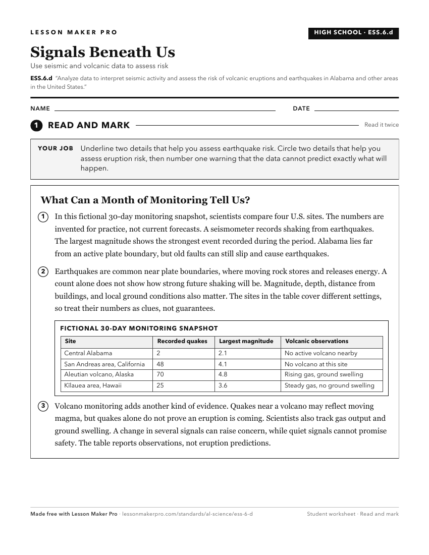
A ready-to-print activity worksheet aligned to ESS.6.d, with an answer key for the teacher on its own page. No account needed.
PDF, US Letter, prints cleanly in black and white.
Download the worksheetKeep exploring
Related Standards
- ESS.5.d
Obtain, evaluate, and communicate information about important tectonic and geologic events that have occurred in Alabama over geologic time.
- ESS.4.e
Obtain and communicate information about significant geologic characteristics in Alabama and the southeastern United States.
- ES.3.b
Analyze and interpret data collected through geographic research and field investigations to describe Alabama’s biodiversity by region.
- ESS.8.c
Communicate scientific information to explain the personal, local, and statewide implications of severe weather events in Alabama.
Turn this exact standard into a lesson
Grade, subject, topic, and the complete standard are prefilled. Create one free, no account needed.
Also for this standard:Make a WorksheetMake a QuizMake a Sub Lesson