Virginia SOL VS.1.c
The Standard
- VS.1
- The student will apply history and social science skills to explain the relationship between physical geography and the lives of Virginia’s peoples, past and present by
locating, identifying, and describing the impact of Virginia’s bodies of water on its history, economy, and culture.
Virginia Standards of Learning for History and Social Science
Teacher's field guide
What This Standard Means
What Students Need to Do
- Students locate and label Virginia’s major rivers, the Chesapeake Bay, and the Atlantic Ocean on a map. They explain how waterways shaped settlement, travel, trade, food, jobs, and local traditions.
What Mastery Looks Like
- Students accurately identify the Potomac, Rappahannock, York, and James rivers, along with the Chesapeake Bay and Atlantic Ocean. They give clear cause and effect examples, such as the James River supporting Jamestown and the Chesapeake Bay supporting fishing and shipping.
Common Misconceptions
- Students may confuse the Chesapeake Bay with the Atlantic Ocean or place rivers in the wrong order. They may think waterways affected only early settlers, overlooking current shipping, seafood, tourism, and recreation.
How to Assess It
- Give students a blank Virginia map and ask them to label three waterways. Then have them explain one historical effect and one economic or cultural effect of a labeled waterway.
Lesson moves
Ways to Teach It
Give pairs a blank Virginia map, blue yarn, and name cards to build and label the James, York, Rappahannock, Potomac, and Chesapeake Bay.
Ask students to write: How would life in Jamestown have changed if the James River were not nearby? Use two specific effects.
Run a card match: students pair each water body with a trade, settlement, food, or travel effect, then defend one match.
Use a Port of Virginia shipping map to trace one imported product from the Chesapeake Bay to a nearby store.
Free download
Printable VS.1.c Worksheet
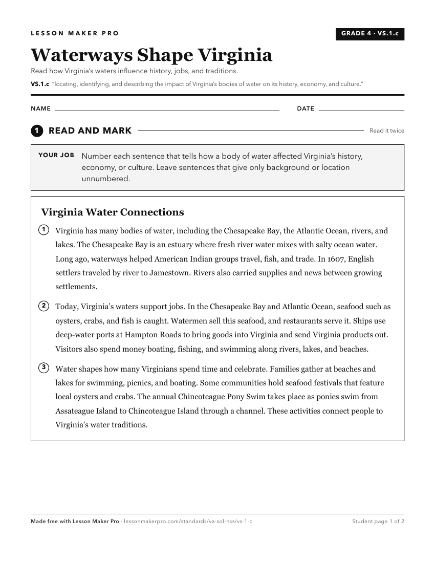
A ready-to-print activity worksheet aligned to VS.1.c, with an answer key for the teacher on its own page. No account needed.
PDF, US Letter, prints cleanly in black and white.
Download the worksheetKeep exploring
Related Standards
- 3.3.a
identifying and locating major bodies of water
- 1.7.a
identifying landforms and bodies of water of Virginia and describing how they affect the way people live
- VS.9.a
explaining the importance of railroads, waterways, new industries, and the growth of cities to Virginia’s economic development in the late 1800s
- VS.1.b
locating and describing the relative location and physical characteristics of Virginia's five geographic regions on a map
Turn this exact standard into a lesson
Grade, subject, topic, and the complete standard are prefilled. Create one free, no account needed.
Also for this standard:Make a WorksheetMake a QuizMake a Sub Lesson