Oklahoma Social Studies MWH.C.1.2
Standard Cluster
- MWH.C.1
- Analyze the impact of the patterns of ancient political, economic, and cultural development.
Explain how geographical and environmental factors impacted settlement and cultural development. Explain different ways in which societies interact across regions (e.g., trade, exploration, colonization) resulting in cultural diffusion (e.g., the Silk Road, Trans-Saharan exchange, Black Death). Describe the institution of slavery prior to the 15th century as a widespread result of warfare and economic practices.
Oklahoma Academic Standards for Social Studies (2026) · MWH.C.1
Cluster contents
Standards in This Cluster
MWH.C.1.2 is a cluster heading. These are the individual standards under it.
- MWH.C.1.2.A
Explain different ways in which societies interact across regions (e.g., trade, exploration, colonization) resulting in cultural diffusion (e.g., the Silk Road,...
- MWH.C.1.2.B
Describe the institution of slavery prior to the 15th century as a widespread result of warfare and economic practices.
Teacher's field guide
What This Cluster Means
What Students Need to Do
- Students use maps to explain why people settled near rivers, oases, and trade routes. They trace how trade, exploration, and colonization spread beliefs, goods, and disease between regions. They explain how warfare and economic practices led to enslavement in many societies before 1500.
What Mastery Looks Like
- Given a map, students explain why a town grew beside the Niger River rather than deep in the Sahara. They trace how trans-Saharan caravans spread Islam and how Silk Road networks carried the Black Death. They name war captivity and debt as two routes into enslavement before 1500.
Common Misconceptions
- Students may see deserts as empty barriers and miss the oasis stops that supported caravan trade. They may think traders moved only goods, not beliefs or disease. They may think slavery began with Atlantic plantations or worked the same way in every society.
How to Assess It
- On a map showing the Sahara, Niger River, and caravan routes, ask students to explain why a town grew by the river, how trade spread Islam, and how war captivity or debt could lead to enslavement before 1500.
Lesson moves
Ways to Teach It
Give pairs an Africa map and colored pencils; have them plot the Niger River, Saharan oases, and a caravan route, then place Timbuktu.
Ask students to write how Silk Road travelers carried Buddhism and how their trade networks also spread the Black Death.
Give groups cards showing war captives, debt bondage, river farming, and oasis trade; have them sort causes of enslavement from settlement factors.
Use an imported fruit label and world map; students trace its route to their grocery store and name a dish that uses it.
Free download
Printable MWH.C.1.2 Worksheet
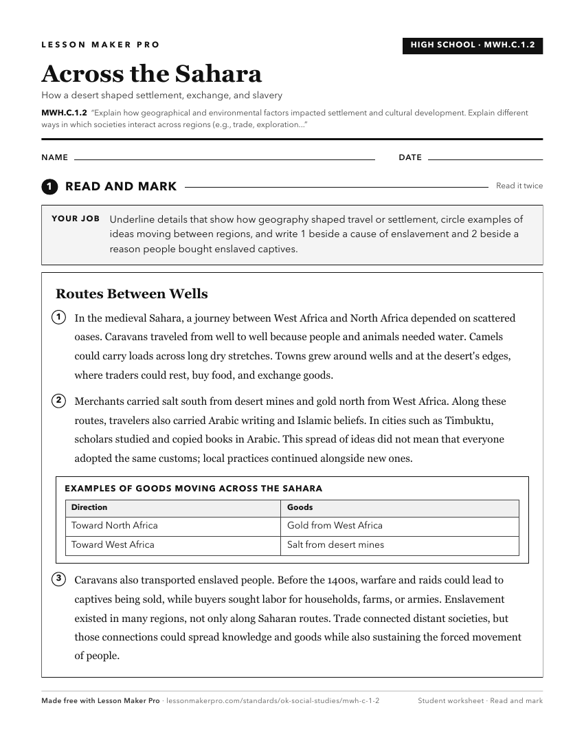
A ready-to-print activity worksheet aligned to MWH.C.1.2, with an answer key for the teacher on its own page. No account needed.
PDF, US Letter, prints cleanly in black and white.
Download the worksheetKeep exploring
Related Standards
- 5.P.2.3.C
Explain how environmental factors affected historical events and continue to impact contemporary human activities.
- 6.P.2.3.C
Explain how the environment affects cultural patterns and historical events, providing opportunities and challenges for human development.
- 4.P.2.3.C
Explain how environmental factors affected historical events and continue to impact contemporary human activities.
- 7.C.2.2
Describe how the physical environment can influence human population distribution, population growth, settlement patterns, land use, and economic activities.
Turn this cluster into a lesson
Grade, subject, topic, and the complete cluster are prefilled. Create one free, no account needed.
Also for this cluster:Make a WorksheetMake a QuizMake a Sub Lesson