Idaho Social Studies 2.SS.2.1.c
The Standard
- 2.SS.2.1
- Develop geographic mapping skills using maps and globes by
locating the countries of North America and the bordering oceans
Idaho Content Standards: K-12 Social Studies · Geography: Students will analyze the spatial organizations of people, places, and environment on the earth’s surface and explain how human actions modify the physical environment and how physical systems affect human activity and living conditions.
Teacher's field guide
What This Standard Means
What Students Need to Do
- Students find North America on a map and locate its countries, including Canada, the United States, Mexico, and countries in Central America and the Caribbean. They point to the Pacific, Atlantic, and Arctic Oceans.
What Mastery Looks Like
- On a blank map, students label Canada, the United States, and Mexico. Using a labeled map, they find countries farther south and identify which ocean lies west, east, and north of the continent.
Common Misconceptions
- Students may think North America is a country or that it ends at Mexico. They may switch the Pacific and Atlantic or mistake the Gulf of Mexico for an ocean.
How to Assess It
- Give students a blank map of North America. Ask them to label Canada, the United States, Mexico, and the Pacific, Atlantic, and Arctic Oceans.
Lesson moves
Ways to Teach It
Give pairs a blank map and cutout labels for Canada, the United States, Mexico, Guatemala, Cuba, and the three oceans to place.
Show a map of Mexico and Guatemala and ask, "Where does North America continue south of the United States?"
Play map bingo: call out country and ocean names while students cover each place on a labeled map.
Trace a flight from your town to Mexico City on a map, then mark the oceans bordering North America.
Free download
Printable 2.SS.2.1.c Worksheet
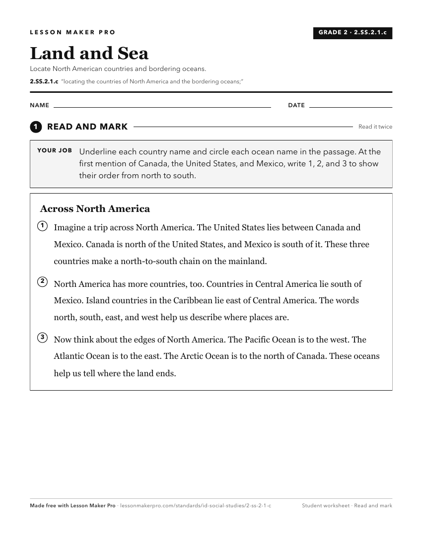
A ready-to-print activity worksheet aligned to 2.SS.2.1.c, with an answer key for the teacher on its own page. No account needed.
PDF, US Letter, prints cleanly in black and white.
Download the worksheetKeep exploring
Related Standards
- 2.SS.2.1.d
Identifying and locating the seven continents and the five oceans
- 6-9.WG.2.7
Identify the names and locations of countries and major cities in regions around the world.
- 1.SS.2.1.c
locating Idaho, the United States, continents, and oceans on maps and globes
- K.SS.2.1.d
identifying the geographic location of the United States and Idaho on a map and globe.
Turn this exact standard into a lesson
Grade, subject, topic, and the complete standard are prefilled. Create one free, no account needed.
Also for this standard:Make a WorksheetMake a QuizMake a Sub Lesson