Florida SS.8.G.2.2
The Standard
- SS.8.G.2
- Understand physical and cultural characteristics of places.
Use geographic terms and tools to analyze case studies of regional issues in different parts of the United States that have had critical economic, physical, or political ramifications.
Florida Next Generation Sunshine State Standards for Social Studies
Teacher's field guide
What This Standard Means
What Students Need to Do
- Students use maps, graphs, data tables, and geographic terms to study regional problems across the United States. They explain how location and physical features shape economic, environmental, or political outcomes.
What Mastery Looks Like
- Students interpret a map’s scale, legend, patterns, and regional boundaries correctly. They use evidence from more than one source to explain causes and effects of issues such as drought, hurricanes, or migration.
Common Misconceptions
- Students may treat regions as fixed political borders or assume one map tells the whole story. They may list effects without connecting them to location, climate, population, resources, or government decisions.
How to Assess It
- Give students a FEMA flood risk map and population map for the Gulf Coast. Ask them to identify one high-risk area and explain one likely economic or political effect using map evidence.
Lesson moves
Ways to Teach It
Overlay printed Gulf Coast rainfall, population, and flood zone maps, then mark the community facing the greatest combined risk.
Write a claim answering: Should Colorado River water favor cities, farms, or ecosystems? Support it with two mapped facts.
Run a map relay where teams identify scale, legend, region, and spatial patterns before naming one likely consequence.
Use a Florida evacuation map and census data to choose a new shelter location, then justify the choice with geographic evidence.
Free download
Printable SS.8.G.2.2 Worksheet
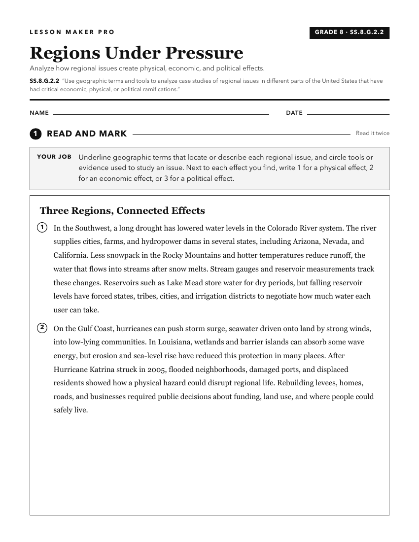
A ready-to-print activity worksheet aligned to SS.8.G.2.2, with an answer key for the teacher on its own page. No account needed.
PDF, US Letter, prints cleanly in black and white.
Download the worksheetKeep exploring
Related Standards
- SS.8.G.4.2
Use geographic terms and tools to analyze the effects throughout American history of migration to and within the United States, both on the place of origin and ...
- SS.8.G.1.2
Use appropriate geographic tools and terms to identify and describe significant places, and regions in American history.
- SS.8.G.4.5
Use geographic terms and tools to analyze case studies of the development, growth, and changing nature of cities and urban centers in the United States over tim...
- SS.8.G.2.3
Use geographic terms and tools to analyze case studies of how selected regions of the United States have changed over time.
Turn this exact standard into a lesson
Grade, subject, topic, and the complete standard are prefilled. Create one free, no account needed.
Also for this standard:Make a WorksheetMake a QuizMake a Sub Lesson