Alabama Social Studies SS24.8.5
Standard Cluster
Compare the African kingdoms of Ghana, Mali, and Songhai, including cultures, economic systems, geography, religions, and slave trade. 5a Describe how physical geography shaped the growth of medieval African kingdoms and trade with neighboring regions. 5b Trace the spread of culture, language, and religion among African civilizations. 5c Evaluate the economic and cultural contributions of key leaders and trade centers in African kingdoms, including Mansa Musa and the city of Timbuktu.
2024 Alabama Course of Study: Social Studies
Cluster contents
Standards in This Cluster
SS24.8.5 is a cluster heading. These are the individual standards under it.
- SS24.8.5a
Describe how physical geography shaped the growth of medieval African kingdoms and trade with neighboring regions.
- SS24.8.5b
Trace the spread of culture, language, and religion among African civilizations.
- SS24.8.5c
Evaluate the economic and cultural contributions of key leaders and trade centers in African kingdoms, including Mansa Musa and the city of Timbuktu.
Teacher's field guide
What This Cluster Means
What Students Need to Do
- Students compare Ghana, Mali, and Songhai by location, trade, culture, and religion. They explain how the Sahara and Niger River shaped trade, and how merchants spread Islam and Arabic. They describe Mansa Musa, Timbuktu, and the sale of enslaved people across the Sahara.
What Mastery Looks Like
- A student places the three kingdoms on a map and timeline, then explains why trade routes grew near the desert and river. They identify gold and salt as shared trade goods and describe how Islam spread. They explain how Mansa Musa supported Timbuktu's growth as a center of learning.
Common Misconceptions
- Students may mistake the medieval kingdom of Ghana for the country of Ghana today, or think all three kingdoms rose at the same time. They may assume everyone practiced Islam. Some confuse the trans-Saharan slave trade with the later Atlantic slave trade.
How to Assess It
- Give students a blank map and ask them to label the Sahara, Niger River, and Timbuktu. Then ask: How did geography help Timbuktu become a trade and learning center?
Lesson moves
Ways to Teach It
Give pairs an outline map to label the Sahara, Niger River, and three kingdoms, then draw a gold and salt trade route.
Write 'gold, salt, enslaved people' on the board; ask why listing people as cargo hides what happened to them.
Give teams fact cards for Ghana, Mali, and Songhai, including Koumbi Saleh, Mansa Musa, and Askia Muhammad; have them sort and defend matches.
Open a current map of Mali, trace roads and the Niger River near Timbuktu, and compare ways people move supplies there.
Free download
Printable SS24.8.5 Worksheet
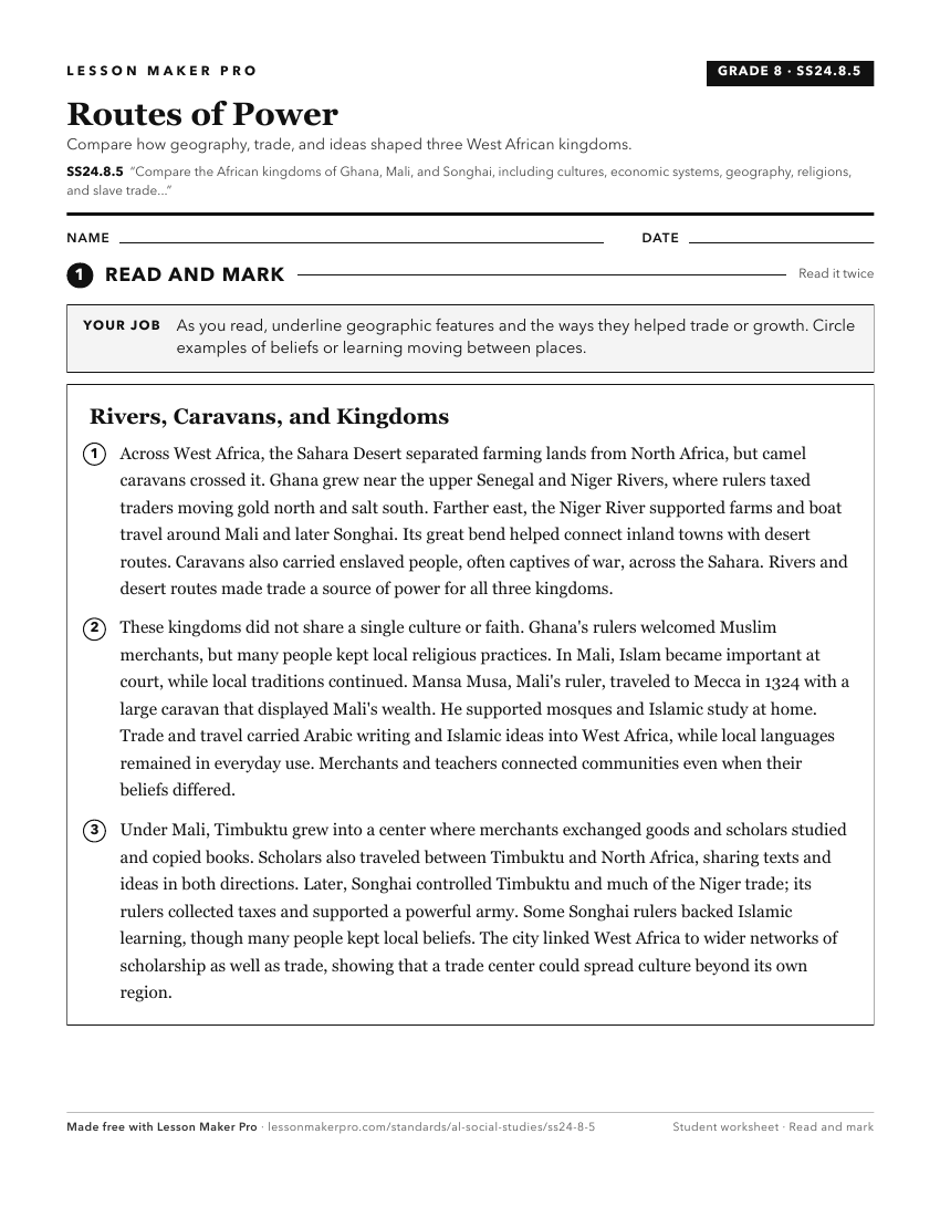
A ready-to-print activity worksheet aligned to SS24.8.5, with an answer key for the teacher on its own page. No account needed.
PDF, US Letter, prints cleanly in black and white.
Download the worksheetKeep exploring
Related Standards
Turn this cluster into a lesson
Grade, subject, topic, and the complete cluster are prefilled. Create one free, no account needed.
Also for this cluster:Make a WorksheetMake a QuizMake a Sub Lesson