Alabama Social Studies SS24.4.14b
The Standard
- SS24.4.14
- Evaluate how key figures contributed to events that shaped the United States’ victory in the Civil War.
Locate and describe the impact of significant Civil War battles, including those affecting Alabama, and identify the location of Confederate states, states remaining loyal to the United States, and capital cities of the Confederacy and United States.
2024 Alabama Course of Study: Social Studies
Teacher's field guide
What This Standard Means
What Students Need to Do
- Students sort states by which side they joined during the Civil War. On a map, they mark Washington, Montgomery, and Richmond, then locate major battles and explain what changed after each one.
What Mastery Looks Like
- A student places Gettysburg in Pennsylvania, Vicksburg in Mississippi, and Mobile Bay in Alabama. They link Gettysburg to a failed Confederate push north, Vicksburg to Union control of the Mississippi River, and Mobile Bay to the loss of a Confederate port. They label Washington as the U.S. capital, Montgomery as the first Confederate capital, and Richmond as the later one.
Common Misconceptions
- Students may put Gettysburg in Virginia because many Civil War battles happened there. Some think every slave state joined the Confederacy, but Kentucky and Maryland remained in the Union. Others name Richmond as the only Confederate capital and miss Montgomery's earlier role.
How to Assess It
- Give students a labeled Civil War map. Ask them to color Alabama and Pennsylvania by side, mark the three capitals, and write one effect of the Union victory at Mobile Bay.
Lesson moves
Ways to Teach It
Give students a blank map and colored stickers to mark Gettysburg, Vicksburg, Mobile Bay, Washington, Montgomery, and Richmond.
Ask pairs, "Why did losing Vicksburg hurt the Confederacy? Use the river on your map to support your answer."
Play a map match: students place battle cards on a map and pair each one with an impact card.
Show a current Alabama map, find Mobile Bay and Montgomery, then discuss why controlling a Gulf port could affect inland supplies.
Free download
Printable SS24.4.14b Worksheet
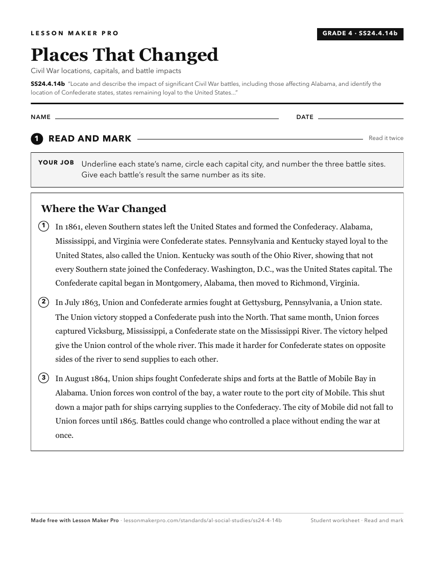
A ready-to-print activity worksheet aligned to SS24.4.14b, with an answer key for the teacher on its own page. No account needed.
PDF, US Letter, prints cleanly in black and white.
Download the worksheetKeep exploring
Related Standards
- SS24.AS.11c
Assess the impacts of the Civil War on Alabama’s economy and infrastructure, and identify battles and campaigns that affected these.
- SS24.AS.11
Outline Alabama’s participation in events leading to the Civil War and in the war itself, and explain how the war created change within the state.
- SS24.4.13d
Summarize Alabama’s role in the formation of the Confederate States of America, including the pivotal events that took place in Montgomery and the division over...
- SS24.4.14a
Identify Alabama’s economic and military contributions to the Civil War, including weapons manufacturing, soldiers, and the use of and resistance to conscripted...
Turn this exact standard into a lesson
Grade, subject, topic, and the complete standard are prefilled. Create one free, no account needed.
Also for this standard:Make a WorksheetMake a QuizMake a Sub Lesson