NY Social Studies 9.3a
The Standard
Geographic factors encouraged and hindered a state’s/empire’s expansion and interactions.
New York State K–12 Social Studies Framework
Key Idea 9.3
CLASSICAL CIVILIZATIONS: EXPANSION, ACHIEVEMENT, DECLINE: Classical civilizations in Eurasia and Mesoamerica employed a variety of methods to expand and maintain control over vast territories. They developed lasting cultural achievements. Both internal and external forces led to the eventual decline of these empires.
Teacher's field guide
What This Standard Means
What Students Need to Do
- Students locate Greece, Gupta, Han, Maurya, Maya, Qin, and Rome on maps, then compare their territory and regional influence. They use map evidence to explain how landforms, waterways, climate, and distance shaped Greek, Roman, and Maya growth and contact.
What Mastery Looks Like
- Students can compare two civilizations using accurate evidence from political and physical maps. They can explain why a geographic feature helped movement, trade, or conquest in one case but created a barrier in another.
Common Misconceptions
- Students may assume the largest territory always had the most power. They may treat geography as the only cause of expansion or view the Maya as one unified empire. Modern borders can also lead them to misread ancient territory.
How to Assess It
- Give students a physical map of the Mediterranean or Mesoamerica. Ask them to identify one feature that supported expansion and one that limited it, citing map evidence.
Lesson moves
Ways to Teach It
Give pairs physical and political maps, colored pencils, and tracing paper to mark routes, barriers, resources, and territorial boundaries.
Ask students to write: Which mattered more for Roman growth, the Mediterranean Sea or the Alps? Support your claim with two map details.
Run a card sort where teams match geographic features with effects on Greek, Roman, or Maya trade, travel, defense, and conquest.
Have students compare an ancient trade route with a modern highway or shipping route, then explain which geographic limits still shape movement.
Free download
Printable 9.3a Worksheet
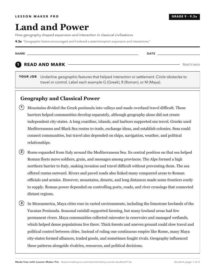
A ready-to-print activity worksheet aligned to 9.3a, with an answer key for the teacher on its own page. No account needed.
PDF, US Letter, prints cleanly in black and white.
Download the worksheetTurn this exact standard into a lesson
Grade, subject, topic, and the complete standard are prefilled. Create one free, no account needed.
Also for this standard:Make a WorksheetMake a QuizMake a Sub Lesson