NY Social Studies 9.10a
The Standard
Various motives, new knowledge, and technological innovations influenced exploration and the development of European transoceanic trade routes.
New York State K–12 Social Studies Framework
Key Idea 9.10
INTERACTIONS AND DISRUPTIONS: Efforts to reach the Indies resulted in the encounter between the people of Western Europe, Africa, and the Americas. This encounter led to a devastating impact on populations in the Americas, the rise of the transatlantic slave trade, and the reorientation of trade networks.
Teacher's field guide
What This Standard Means
What Students Need to Do
- Students identify economic, religious, and political reasons for European ocean voyages. They explain how wind patterns, ocean currents, maps, navigation tools, and ship designs made longer routes possible. They also examine why Isabella and Ferdinand funded Columbus.
What Mastery Looks Like
- Students can connect a motive, a piece of geographic knowledge, and a technology in a clear cause-and-effect explanation. They can use a map or source to explain why a route was chosen and how royal support affected exploration.
Common Misconceptions
- Students may think better ships alone caused exploration or that Europeans invented every navigation tool they used. They may also confuse reaching Asian markets with finding an unknown, uninhabited land. Some assume Isabella and Ferdinand sailed rather than financed Columbus.
How to Assess It
- Give students an Atlantic wind map and a caravel diagram. Ask them to explain Spain's westward voyage using one motive, one knowledge factor, and one technology.
Lesson moves
Ways to Teach It
Use a laminated Atlantic map, paper ships, and route arrows to test how winds, currents, and ship design changed possible voyages.
Write a six-sentence response explaining why Isabella and Ferdinand funded Columbus and what made his voyage possible.
Sort motive, knowledge, technology, and outcome cards, then race to build three accurate cause-and-effect chains.
Compare a current cargo route on an online ship-tracking map with a historic route, marking where weather data and navigation tools affect decisions.
Free download
Printable 9.10a Worksheet
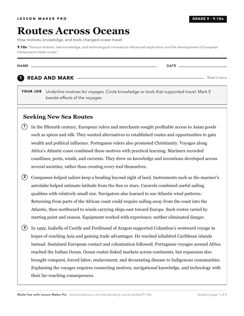
A ready-to-print activity worksheet aligned to 9.10a, with an answer key for the teacher on its own page. No account needed.
PDF, US Letter, prints cleanly in black and white.
Download the worksheetTurn this exact standard into a lesson
Grade, subject, topic, and the complete standard are prefilled. Create one free, no account needed.
Also for this standard:Make a WorksheetMake a QuizMake a Sub Lesson