NY Social Studies 7.8a
The Standard
Early United States industrialization affected different parts of the country in different ways. Regional economic differences and values, as well as different conceptions of the Constitution, laid the basis for tensions between states’ rights advocates and supporters of a strong federal government.
New York State K–12 Social Studies Framework
Key Idea 7.8
A NATION DIVIDED: Westward expansion, the industrialization of the North, and the increase of slavery in the South contributed to the growth of sectionalism. Constitutional conflicts between advocates of states’ rights and supporters of federal power increased tensions in the nation; attempts to compromise ultimately failed to keep the nation together, leading to the Civil War.
Teacher's field guide
What This Standard Means
What Students Need to Do
- Students compare how factories, plantation agriculture, small farms, transportation, and labor systems shaped the North, South, and West. They connect regional interests to disputes over tariffs, federal spending, and government power.
What Mastery Looks Like
- Students can use maps, economic data, and short primary sources to identify regional patterns. They can make an evidence-based claim explaining why regions supported different national policies.
Common Misconceptions
- Students may assume industrialization spread evenly or that every Northerner worked in a factory and every Southerner owned enslaved people. They may also treat states’ rights as a fixed principle rather than an argument used selectively to protect regional interests.
How to Assess It
- Use this exit prompt: “A Northern mill owner supports a protective tariff, while a Southern cotton planter opposes it. Explain both positions using economic evidence.”
Lesson moves
Ways to Teach It
Give pairs economy cards for mills, cotton, canals, railroads, and farms to place on a North, South, and West map.
Ask students to write: “How could a region’s economy shape its view of federal power?” Require two specific examples.
Run a policy vote with regional role cards covering tariffs, roads, canals, and banking, then have students justify each vote.
Compare a current state employment map with an 1850 economic map, then identify how regional jobs can shape political priorities.
Free download
Printable 7.8a Worksheet
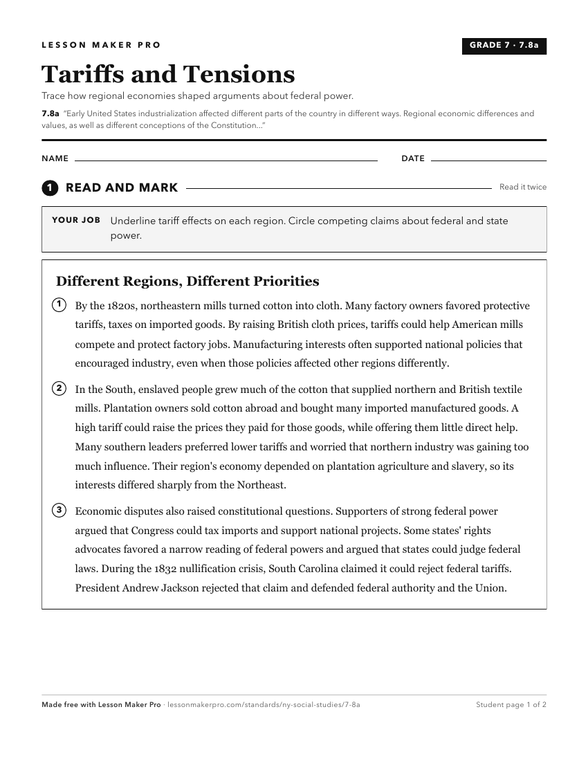
A ready-to-print activity worksheet aligned to 7.8a, with an answer key for the teacher on its own page. No account needed.
PDF, US Letter, prints cleanly in black and white.
Download the worksheetTurn this exact standard into a lesson
Grade, subject, topic, and the complete standard are prefilled. Create one free, no account needed.
Also for this standard:Make a WorksheetMake a QuizMake a Sub Lesson