NY Social Studies 6.7c
The Standard
Complex societies and civilizations adapted and designed technologies for transportation that allowed them to cross challenging landscapes and move people and goods efficiently.
New York State K–12 Social Studies Framework
Key Idea 6.7
INTERACTIONS ACROSS THE EASTERN HEMISPHERE (ca. 600 C.E. – ca. 1450): Trade networks promoted the exchange and diffusion of language, belief systems, tools, intellectual ideas, inventions, and diseases.
Teacher's field guide
What This Standard Means
What Students Need to Do
- Students identify how ship designs, sails, rudders, compasses, and astrolabes improved travel and trade. They connect each technology to specific routes, landscapes, weather, and cargo. They explain how gunpowder changed control of trade routes and ports.
What Mastery Looks Like
- Students can choose suitable transportation and navigation tools for a given trade route and explain each choice. They can compare junks and caravels using details about design, steering, cargo, and travel conditions.
Common Misconceptions
- Students may assume all societies used the same ships and navigation tools. They may confuse the compass with the astrolabe or think either tool showed an exact location. Some treat gunpowder as a transportation technology rather than a tool for defense and control.
How to Assess It
- Give students a route across the Indian Ocean and ask them to choose two technologies from a word bank. They must explain how each would make the trip safer or more efficient.
Lesson moves
Ways to Teach It
Use foil boats, index-card sails, and a tub of water to test how sail and rudder changes affect control and cargo capacity.
Ask students to defend which tool, compass, astrolabe, sail, or rudder, best reduced risk on an Indian Ocean voyage.
Run a route-card game where teams match junks, caravels, caravans, compasses, and astrolabes to terrain, weather, cargo, and destination.
Compare a medieval trade route with a modern shipping map, then list technologies each system uses to handle distance, weather, and hazards.
Free download
Printable 6.7c Worksheet
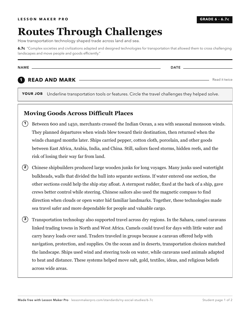
A ready-to-print activity worksheet aligned to 6.7c, with an answer key for the teacher on its own page. No account needed.
PDF, US Letter, prints cleanly in black and white.
Download the worksheetTurn this exact standard into a lesson
Grade, subject, topic, and the complete standard are prefilled. Create one free, no account needed.
Also for this standard:Make a WorksheetMake a QuizMake a Sub Lesson