NY Social Studies 6.1b
The Standard
The Eastern Hemisphere can be divided into regions. Regions are areas that share common identifiable characteristics, such as physical, political, economic, or cultural features. Regions within the Eastern Hemisphere include: • Middle East (North Africa and Southwest Asia) • Sub-Saharan Africa • Europe (West, North, South, Central, and Southeast) • Russia and the Independent States (Russia, Caucasia, Central Asia, the region of Belarus, Moldova, and Ukraine) • East Asia (People’s Republic of China, North Korea, South Korea, Japan, and Taiwan) • Southeast Asia (Vietnam, Cambodia, Laos, Thailand, Myanmar [Burma], Malaysia, Singapore, Indonesia, Brunei, Philippines) • South Asia (Afghanistan, Pakistan, India, Bangladesh, Nepal, Bhutan) • Oceania (Australia, New Zealand, the Pacific)
New York State K–12 Social Studies Framework
Key Idea 6.1
PRESENT-DAY EASTERN HEMISPHERE GEOGRAPHY: The diverse geography of the Eastern Hemisphere has influenced human culture and settlement patterns in distinct ways. Human communities in the Eastern Hemisphere have adapted to or modified the physical environment.
Teacher's field guide
What This Standard Means
What Students Need to Do
- Students locate and name the major regions of the Eastern Hemisphere. They group countries into regions and identify shared physical, political, economic, or cultural features.
What Mastery Looks Like
- Students label the regions on an unlabeled map and place representative countries correctly. They use a specific shared feature to explain why countries are grouped together.
Common Misconceptions
- Students may confuse regions with continents or assume regional boundaries are fixed. Explain that this framework groups North Africa with the Middle East; other sources draw different boundaries. Its Russia and Independent States grouping is for regional study, not a claim of political membership. Oceania includes more than Australia.
How to Assess It
- Give students a blank map and the eight region names. Have them label each region, add one country to each, and write one shared feature for two regions.
Lesson moves
Ways to Teach It
Give groups country cards to sort onto a large floor map, then ask them to explain two placements using shared features.
Ask students to write: Why might two geographers draw different boundaries for the same region?
Play a region clue game using country, climate, language, landform, and trade cards while teams identify the matching region.
Use five international news headlines to locate each event and identify the Eastern Hemisphere region involved.
Free download
Printable 6.1b Worksheet
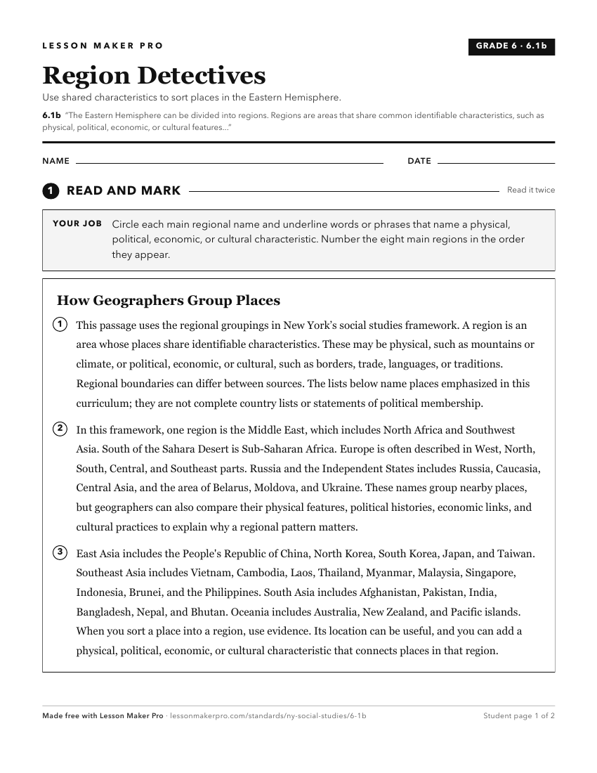
A ready-to-print activity worksheet aligned to 6.1b, with an answer key for the teacher on its own page. No account needed.
PDF, US Letter, prints cleanly in black and white.
Download the worksheetTurn this exact standard into a lesson
Grade, subject, topic, and the complete standard are prefilled. Create one free, no account needed.
Also for this standard:Make a WorksheetMake a QuizMake a Sub Lesson