NY Social Studies 4.6b
The Standard
In order to connect the Great Lakes with the Atlantic Ocean, the Erie Canal was built. Existing towns expanded and new towns grew along the canal. New York City became the busiest port in the country.
New York State K–12 Social Studies Framework
Key Idea 4.6
WESTWARD MOVEMENT AND INDUSTRIALIZATION: New York State played an important role in the growth of the United States. During the 1800s, people traveled west looking for opportunities. Economic activities in New York State are varied and have changed over time, with improvements in transportation and technology.
Teacher's field guide
What This Standard Means
What Students Need to Do
- Students use elevation, rivers, and valleys to predict a practical canal route, then compare it with the route that was built. They map canal communities and products. They explain changes in trade, settlement, New York City, and Haudenosaunee lands.
What Mastery Looks Like
- A student can explain why low land and river valleys made one route practical. On an unlabeled map, the student can trace the route and label five towns and four cities. The student can describe economic growth and one effect on Haudenosaunee communities.
Common Misconceptions
- Students may think the canal is a natural river or runs directly from Buffalo to New York City. They may assume everyone benefited equally, overlooking Haudenosaunee land loss and disruption. They may also confuse cities on the canal with cities elsewhere in New York.
How to Assess It
- Exit ticket: Trace the canal from Buffalo to Albany, label four cities and five smaller communities, and draw arrows showing one shipped product. Write one sentence explaining a benefit and one sentence explaining an effect on Haudenosaunee communities.
Lesson moves
Ways to Teach It
Give pairs a relief map, yarn, and a canal overlay; have them choose the easiest route, then check their prediction.
After reading a merchant account and a Haudenosaunee account, students write one benefit, one harm, and supporting evidence.
Teams place Buffalo, Rochester, Syracuse, Albany, Brockport, Medina, Palmyra, Pittsford, and Canajoharie cards correctly on a floor map.
Compare the time and cost of moving flour by wagon and canal, then choose the better route for a Buffalo miller.
Free download
Printable 4.6b Worksheet
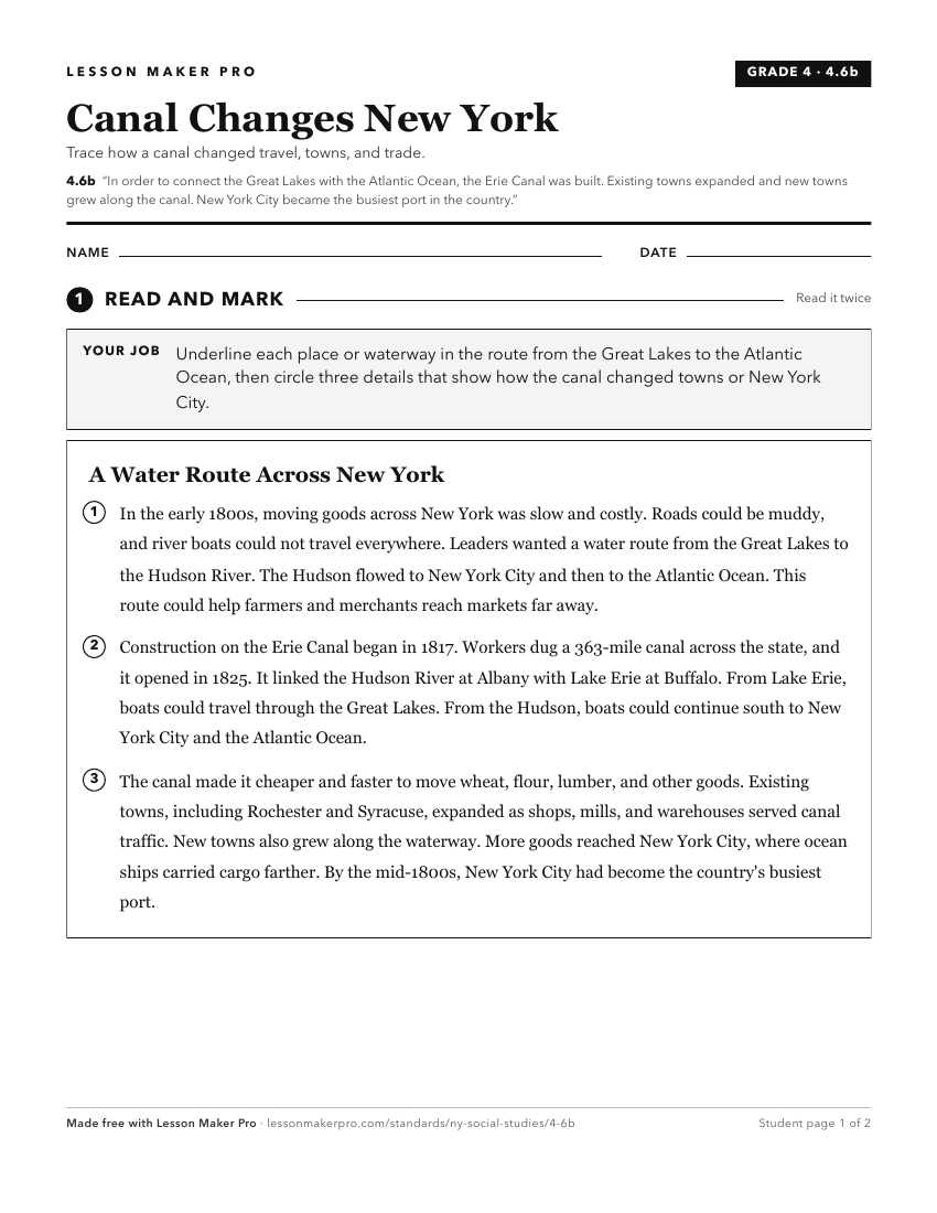
A ready-to-print activity worksheet aligned to 4.6b, with an answer key for the teacher on its own page. No account needed.
PDF, US Letter, prints cleanly in black and white.
Download the worksheetTurn this exact standard into a lesson
Grade, subject, topic, and the complete standard are prefilled. Create one free, no account needed.
Also for this standard:Make a WorksheetMake a QuizMake a Sub Lesson