NY Social Studies 4.3c
The Standard
In the mid-1700s, England and France competed against each other for control of the land and wealth in North America. The English, French, and their Native American allies fought the French and Indian War. Several major battles were fought in New York.
New York State K–12 Social Studies Framework
Key Idea 4.3
COLONIAL AND REVOLUTIONARY PERIOD IN NEW YORK: European exploration led to the colonization of the region that became New York State. Beginning in the early 1600s, colonial New York was home to people from many different countries. Colonial New York was important during the Revolutionary Period.
Teacher's field guide
What This Standard Means
What Students Need to Do
- Students locate major New York battle sites on a map and connect them to forts, lakes, rivers, and travel routes. They explain why Native nations chose different alliances with Britain or France.
What Mastery Looks Like
- Students can identify sites such as Lake George, Fort William Henry, Fort Ticonderoga, Fort Oswego, or Fort Niagara. They can explain how controlling one site affected travel, trade, or military movement.
Common Misconceptions
- Students may think the war was fought between France and Native Americans because of its name. They may also treat Native nations as one group, rather than nations making separate and changing alliance choices.
How to Assess It
- Give students a blank New York map. Ask them to mark two battle sites, explain why one location mattered, and name one Native alliance.
Lesson moves
Ways to Teach It
Students place labeled fort cards on a New York map, then use yarn to trace the waterways and routes each fort controlled.
Give students British, French, Mohawk, and Abenaki viewpoint cards, then ask: What might each group gain or risk through an alliance?
Play a route-control game where teams claim forts and must explain how each location supports trade, supplies, or troop movement.
Compare an eighteenth-century New York waterways map with a modern transportation map, then identify routes that still connect major places.
Free download
Printable 4.3c Worksheet
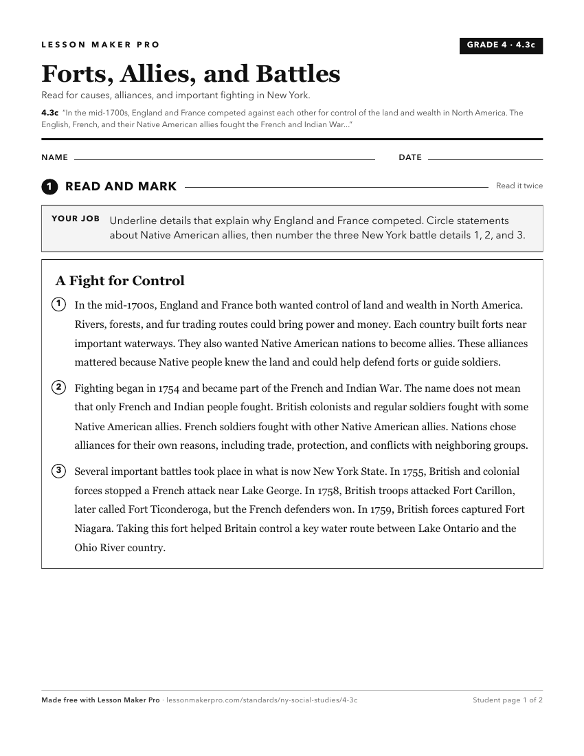
A ready-to-print activity worksheet aligned to 4.3c, with an answer key for the teacher on its own page. No account needed.
PDF, US Letter, prints cleanly in black and white.
Download the worksheetTurn this exact standard into a lesson
Grade, subject, topic, and the complete standard are prefilled. Create one free, no account needed.
Also for this standard:Make a WorksheetMake a QuizMake a Sub Lesson