NY Social Studies 4.2a
The Standard
Geographic factors often influenced locations of early settlements. People made use of the resources and the lands around them to meet their basic needs of food, clothing, and shelter.
New York State K–12 Social Studies Framework
Key Idea 4.2
NATIVE AMERICAN GROUPS AND THE ENVIRONMENT: Native American groups, chiefly the Haudenosaunee (Iroquois) and Algonquian-speaking groups, inhabited the region that became New York State. These people interacted with the environment and developed unique cultures.
Teacher's field guide
What This Standard Means
What Students Need to Do
- Students locate Haudenosaunee and Algonquian-speaking communities on maps of what is now New York. They connect settlement choices to rivers, lakes, forests, soil, landforms, and climate. They explain how communities farmed, hunted, traveled, built homes, and made clothing with local materials.
What Mastery Looks Like
- Given a physical map, students can choose a likely settlement site and support the choice with two geographic details. They can give accurate examples, such as farming fertile soil, fishing waterways, using bark for longhouses, or clearing fields.
Common Misconceptions
- Students may assume all Native American groups lived alike or moved constantly. They may treat New York as one uniform landscape, or think communities adapted to nature without changing it. Some confuse present-day borders and place names with the earlier region.
How to Assess It
- Give students a simple map showing a river, forest, steep hills, and fertile soil. Ask: “Circle the best settlement site, then explain how two map features would help the community.”
Lesson moves
Ways to Teach It
On a tray map, students place blue yarn rivers, paper forests, and clay hills, then position a settlement and justify it.
Write: Which location would better support a community, a wooded river valley or a rocky hilltop, and why?
Play Resource Match: students pair New York resources with uses such as fishing, farming, canoe travel, clothing, and home building.
Compare a local town map with a physical map, then identify which waterways, soils, or landforms may have shaped its location.
Free download
Printable 4.2a Worksheet
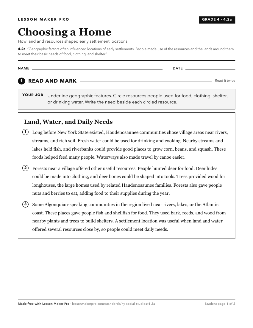
A ready-to-print activity worksheet aligned to 4.2a, with an answer key for the teacher on its own page. No account needed.
PDF, US Letter, prints cleanly in black and white.
Download the worksheetTurn this exact standard into a lesson
Grade, subject, topic, and the complete standard are prefilled. Create one free, no account needed.
Also for this standard:Make a WorksheetMake a QuizMake a Sub Lesson