NY Social Studies 11.1b
The Standard
A number of factors influenced colonial economic development, social structures, and labor systems, causing variation by region.
New York State K–12 Social Studies Framework
Key Idea 11.1
COLONIAL FOUNDATIONS (1607– 1763): European colonization in North America prompted cultural contact and exchange between diverse peoples; cultural differences and misunderstandings at times led to conflict. A variety of factors contributed to the development of regional differences, including social and racial hierarchies, in colonial America.
Teacher's field guide
What This Standard Means
What Students Need to Do
- Students compare New England, Middle, and Southern colonies using geography, settlement patterns, economies, social hierarchies, and labor systems. They explain how slavery became racialized and increasingly concentrated in the South.
What Mastery Looks Like
- Students can connect climate, land, crops, and ports to each region’s economy and settlement patterns. They can distinguish indentured servitude from lifelong hereditary slavery and support comparisons with evidence.
Common Misconceptions
- Students may assume all colonies had the same economy or that slavery existed only in the South. They may treat indentured servitude and slavery as equal systems or overlook how colonial laws made slavery racial and hereditary.
How to Assess It
- Give students three regional maps and ask: “Choose two regions and explain how geography shaped their economies and labor systems. Cite two map details.”
Lesson moves
Ways to Teach It
Groups sort cards showing crops, landforms, port cities, labor systems, and social groups onto regional maps, then explain each placement.
Students write a paragraph answering, “Why did slavery become more concentrated in the Southern colonies?” using three pieces of evidence.
Play a regional clue game where teams identify New England, Middle, or Southern colonies and justify each answer.
Students compare a colonial trade map with a modern population map and identify two port cities whose locations still shape economic activity.
Free download
Printable 11.1b Worksheet
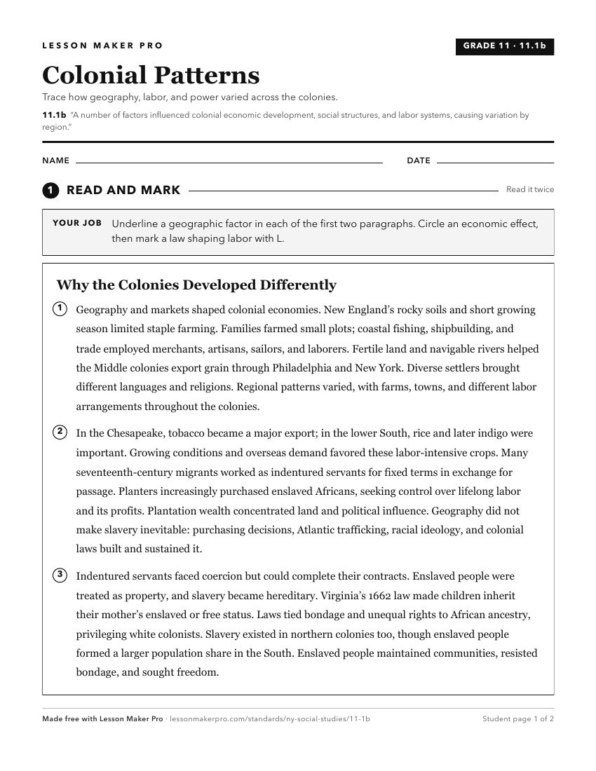
A ready-to-print activity worksheet aligned to 11.1b, with an answer key for the teacher on its own page. No account needed.
PDF, US Letter, prints cleanly in black and white.
Download the worksheetTurn this exact standard into a lesson
Grade, subject, topic, and the complete standard are prefilled. Create one free, no account needed.
Also for this standard:Make a WorksheetMake a QuizMake a Sub Lesson