NY Social Studies 10.4a
The Standard
European industrialized states and Japan sought to play a dominant role in the world and to control natural resources for political, economic, and cultural reasons.
New York State K–12 Social Studies Framework
Key Idea 10.4
IMPERIALISM: Western European interactions with Africa and Asia shifted from limited regional contacts along the coast to greater influence and connections throughout these regions. Competing industrialized states sought to control and transport raw materials and create new markets across the world.
Teacher's field guide
What This Standard Means
What Students Need to Do
- Students explain why industrial powers built empires, using political rivalry, profit, resources, and cultural beliefs as evidence. They compare direct rule, indirect rule, and spheres of influence across Africa and Asia. They also examine how missionaries, local people, women, merchants, and officials experienced imperial control differently.
What Mastery Looks Like
- Students can use examples from South Africa, Congo, Algeria, India, Indochina, and China to identify who held power and how. They can connect a control method to an imperial motive and support claims with evidence from maps or primary sources.
Common Misconceptions
- Students may treat imperialism as simple migration or trade rather than political and economic control. They often confuse direct rule with rule through local leaders. They may assume colonized people responded in one way and overlook resistance, cooperation, negotiation, and adaptation.
How to Assess It
- Exit ticket: Choose Congo, India, Indochina, South Africa, Algeria, or China. Identify the control method, explain one imperial motive, and describe one local response.
Lesson moves
Ways to Teach It
Give groups territory maps and source cards to sort by imperial motive, control method, and perspective, then defend one disputed placement.
Write a response to this prompt: Which mattered more in imperial expansion, economic gain, political rivalry, or cultural beliefs?
Run a matching relay using territory, imperial power, resource, control method, and local response cards.
Trace a modern rubber, tea, or copper supply chain, then compare its map with colonial production and transport routes.
Free download
Printable 10.4a Worksheet
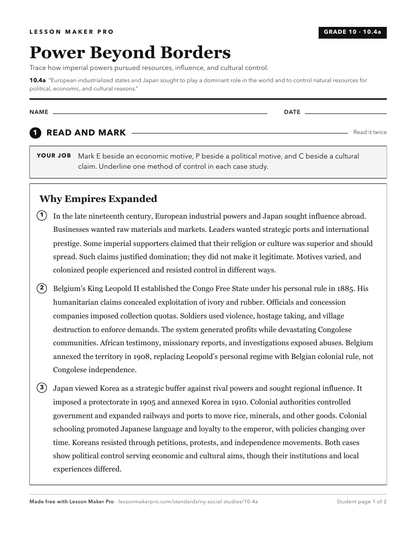
A ready-to-print activity worksheet aligned to 10.4a, with an answer key for the teacher on its own page. No account needed.
PDF, US Letter, prints cleanly in black and white.
Download the worksheetTurn this exact standard into a lesson
Grade, subject, topic, and the complete standard are prefilled. Create one free, no account needed.
Also for this standard:Make a WorksheetMake a QuizMake a Sub Lesson