NY Social Studies 10.1b
The Standard
Perceptions of outsiders and interactions with them varied across Eurasia.
New York State K–12 Social Studies Framework
Key Idea 10.1
THE WORLD in 1750: The world in 1750 was marked by powerful Eurasian states and empires, coastal African kingdoms, and growing European maritime empires. The interactions of these states, empires, and kingdoms disrupted regional trade networks and influenced the development of new global trade networks.
Teacher's field guide
What This Standard Means
What Students Need to Do
- Students compare how Tokugawa leaders and Mughal rulers viewed European merchants, missionaries, and political influence, then trace the results of their choices. They map major powers around 1750 and judge differences in territory, trade access, military strength, and influence.
What Mastery Looks Like
- A student can explain why Tokugawa Japan restricted most European contact while keeping limited trade, and why Mughal authorities often granted trading privileges. The student can locate major powers and explain why territorial size did not always equal regional or global influence.
Common Misconceptions
- Students may describe Tokugawa Japan as completely closed, overlooking controlled trade through Nagasaki and contact with Asian neighbors. They may treat Mughal policy as uniformly welcoming, ignoring changes among rulers, local officials, and trading companies. They may also assume the largest empire was automatically the most powerful.
How to Assess It
- Exit ticket: On a small 1750 map, label Tokugawa Japan, the Mughal Empire, and two European maritime empires. Then name one policy difference, one impact, and one reason map size can mislead.
Lesson moves
Ways to Teach It
Give groups transparent empire outlines, a blank 1750 map, and influence cards; students place, label, and rank each power's regional reach.
Write: Which policy toward Europeans had greater long-term costs, Tokugawa restriction or Mughal trade access? Support your claim with two facts.
Run a card sort matching Tokugawa and Mughal policies to motives, foreign groups, trade routes, and political consequences.
Compare control of Nagasaki and Indian Ocean ports with modern control of shipping hubs, using a current trade map.
Free download
Printable 10.1b Worksheet
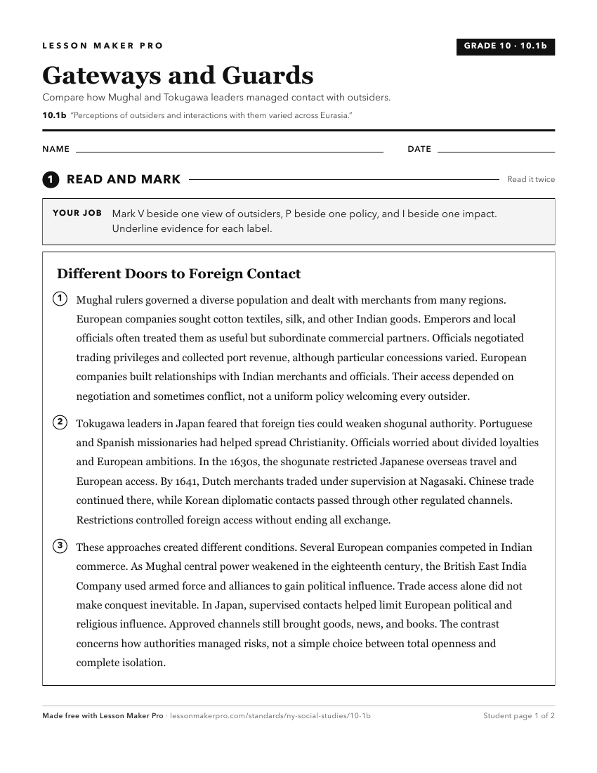
A ready-to-print activity worksheet aligned to 10.1b, with an answer key for the teacher on its own page. No account needed.
PDF, US Letter, prints cleanly in black and white.
Download the worksheetTurn this exact standard into a lesson
Grade, subject, topic, and the complete standard are prefilled. Create one free, no account needed.
Also for this standard:Make a WorksheetMake a QuizMake a Sub Lesson